Skip to content

Mianus River Park

Download the PDF

Mianus River Park

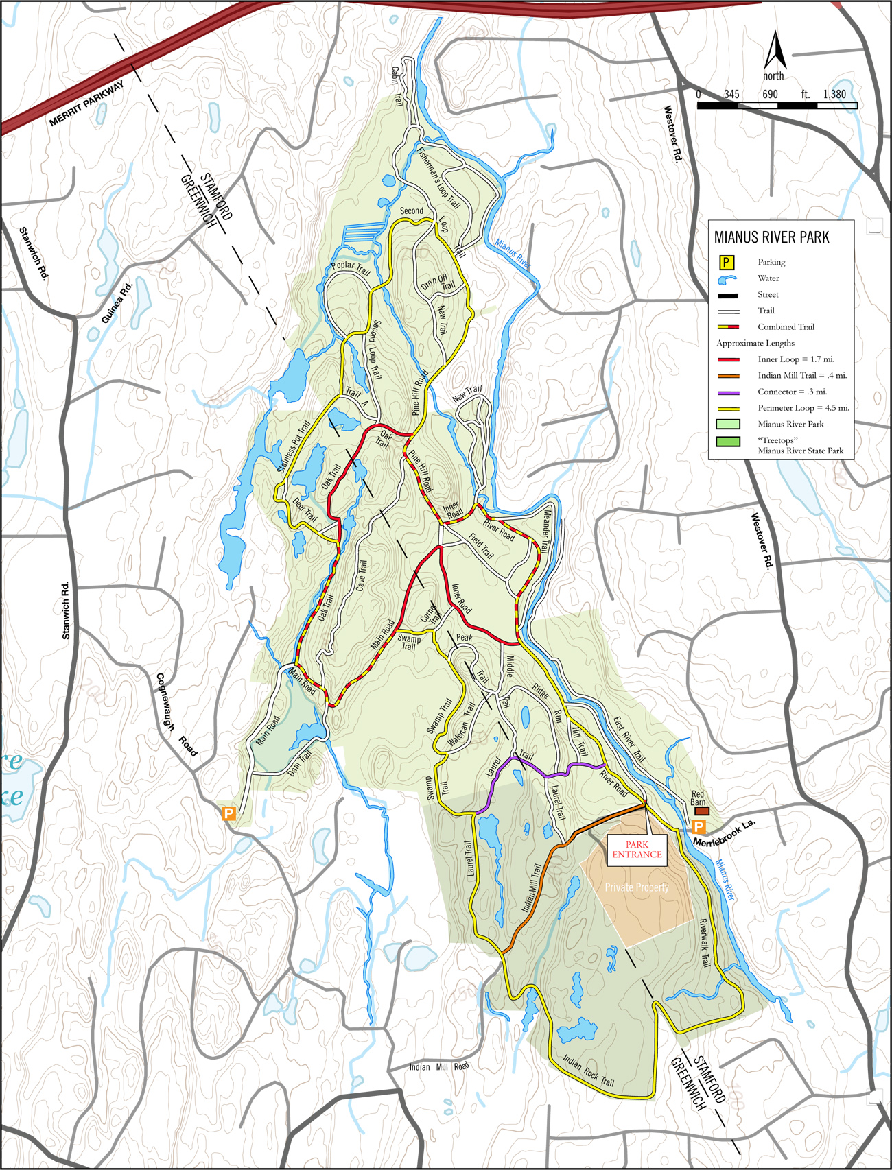
The Mianus River Park is a remarkable jewel of rocky, riparian public land lying mostly to the west of the Mianus River on the Greenwich/Stamford borders, and immediately north of Treetops. It’s almost 300 acres of mature forest and dramatic landscape is parceled between a (west) entrance on Cognewaugh Rd (Greenwich) and another (east) entrance on Merriebrook Lane.
Greenwich Entrance  |  Stamford Entrance 

Upcoming

Workout Wednesday—Trailside Museum

April 2 @ 5:30 am - 7:00 am
Trailside Museum
Reservation Road
Pound Ridge, NY 10576 United States
+ Google Map

Trail Thursday

April 3 @ 5:30 am - 7:00 am
Ward Pound Ridge Reservation, Michigan Road Lot
Michigan Road
Pound Ridge, NY 10576 United States
+ Google Map

Sights and Heights

April 5 @ 7:00 am - 8:30 am
Ward Pound Ridge Reservation, Michigan Road Lot
Michigan Road
Pound Ridge, NY 10576 United States
+ Google Map

Meadow to John Jay

April 6 @ 8:00 am - 10:00 am
Ward Pound Ridge Reservation, Meadow Lot
Reservation Road
Pound Ridge, NY 10576 United States
+ Google Map

Trail Tuesday

April 8 @ 5:30 am - 7:00 am
Ward Pound Ridge Reservation, Michigan Road Lot
Michigan Road
Pound Ridge, NY 10576 United States
+ Google Map

Workout Wednesday—Trailside Museum

April 9 @ 5:30 am - 7:00 am
Trailside Museum
Reservation Road
Pound Ridge, NY 10576 United States
+ Google Map

Trail Thursday

April 10 @ 5:30 am - 7:00 am
Ward Pound Ridge Reservation, Michigan Road Lot
Michigan Road
Pound Ridge, NY 10576 United States
+ Google Map

Museum, CB, to Blue

April 12 @ 7:00 am - 9:00 am
Trailside Museum
Reservation Road
Pound Ridge, NY 10576 United States
+ Google Map

Michigan to Kimberly V3

April 13 @ 8:00 am - 9:30 am
Ward Pound Ridge Reservation, Michigan Road Lot
Michigan Road
Pound Ridge, NY 10576 United States
+ Google Map

Trail Tuesday

April 15 @ 5:30 am - 7:00 am
Ward Pound Ridge Reservation, Michigan Road Lot
Michigan Road
Pound Ridge, NY 10576 United States
+ Google Map

Stay On Course

The Free Avenza Maps software now has a free trail map of the Reservation available here. I’ll make .kml files available as I can so you can load them as layer overlays. Now there’s no excuse to get lost.

Donate

Help keep the site running, kick in something for a night run, or help share the cost of special events by donating. Any amount accepted. Thanks.