Ward Pound Ridge 1940s Map
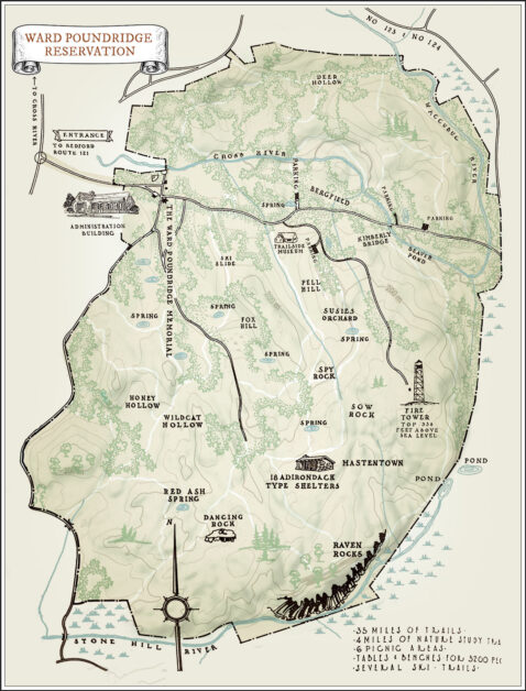
Print Map Ward Pound Ridge Reservation 1940s Map This map of the Rez dates from the 1930s or 1940s. The original was black and white and oriented so that north […]

Print Map Ward Pound Ridge Reservation 1940s Map This map of the Rez dates from the 1930s or 1940s. The original was black and white and oriented so that north […]
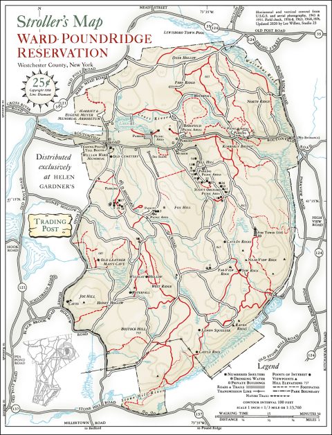
Print Map Download the PDF Ward Pound Ridge Reservation Stroller’s Map This map was sold from the “Trading Post” in the reservation from the 1950s to the 1970s. Visitors could […]
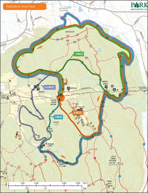
Print Map Download the PDF Trailside to Town Park This course offers runners different distances starting at the Trailside Nature Museum and heading toward Lewisboro Town Park. Options include a […]
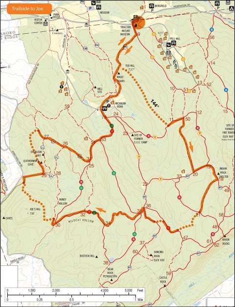
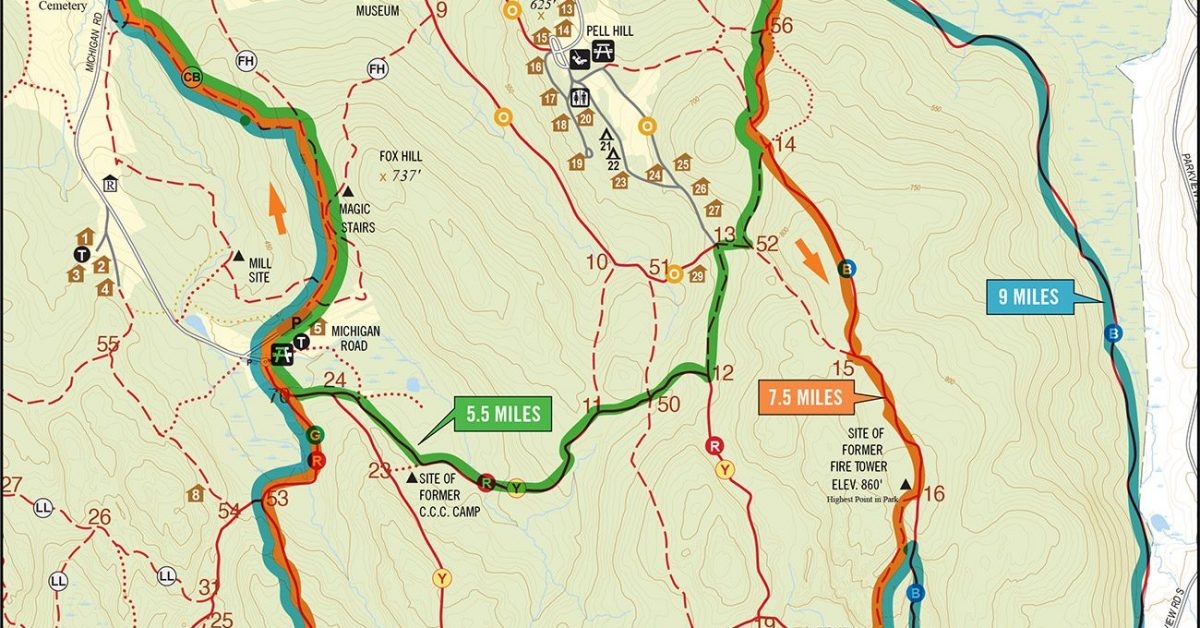
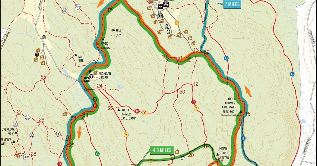
Print Map Download the PDF TRAILSIDE TO JOE 7 Miles This seven-mile course starts at the Trailside Museum and includes three Bushwhacks. Intrepid runners can bring a compass and navigate […]
Print Map Download the PDF Trailside to Green 6mi/8mi Loop This course starts at the Trailside Museum and makes a loop up Blue, down Green, up FH, and down CB. […]
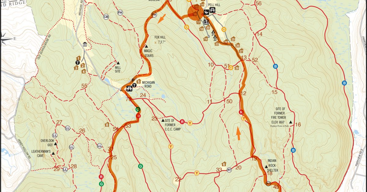
Print Map Download the PDF 6.5 Mile Pell Hill Loop This course starts at the top of Pell Hill opposite lean-to 16 and involves some bushwhacking down the hill to […]
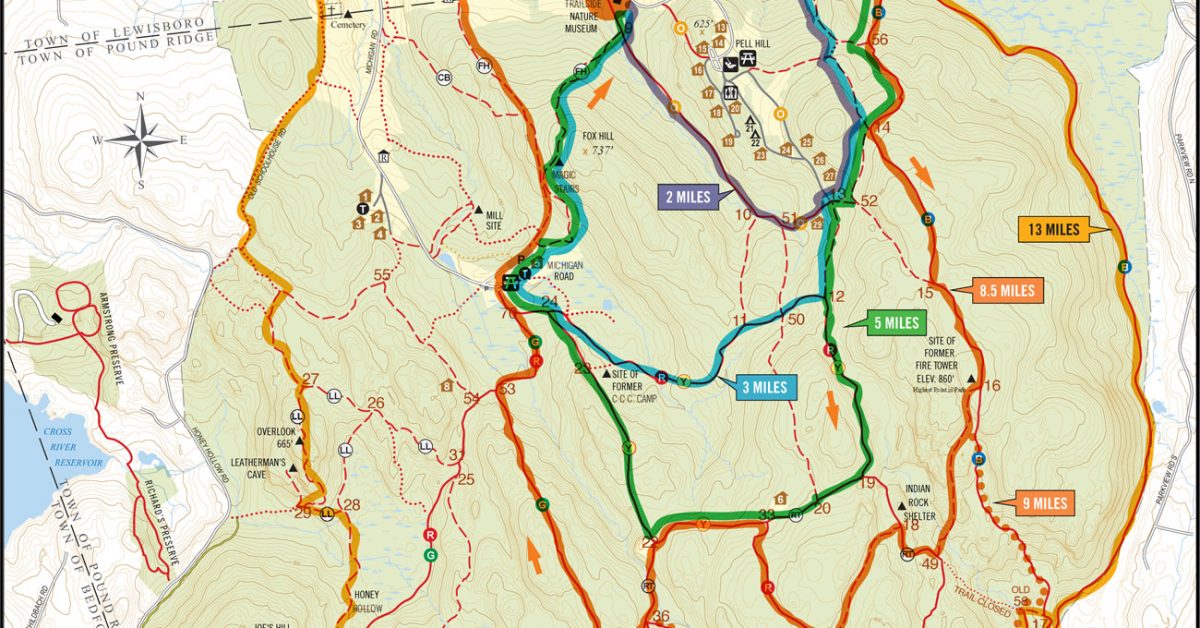
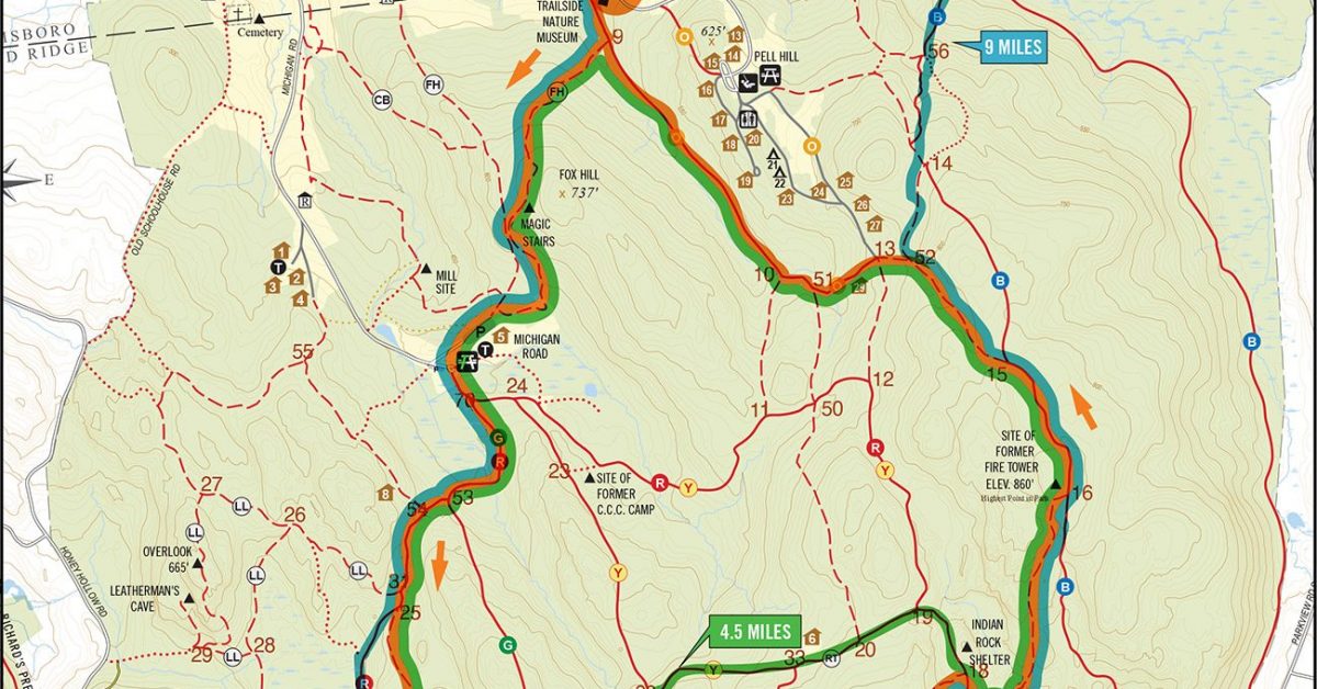
Print Map Download the PDF TRAILSIDE MULTILOOP This course offers runners an opportunity to run different distances or combine one or more (or all) to create a run of over […]
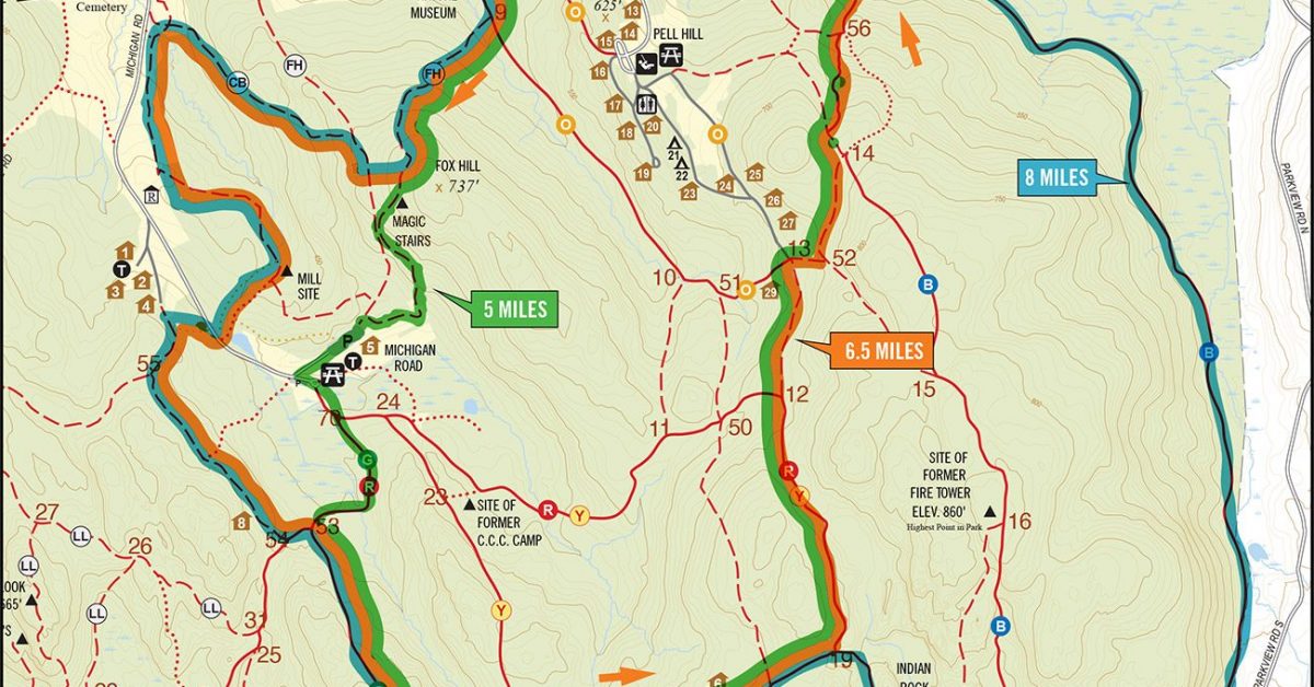
Print Map Download the PDF Trailside, CB, to Blue This course starts at the Trailside Museum and heads up toward the Magic Stairs. You might notice a slight uphill along […]
Print Map Download the PDF Trailside, Raven, to Tower Loop This course starts off with a climb up Fox Hill and down to Michigan Road where we make our way […]
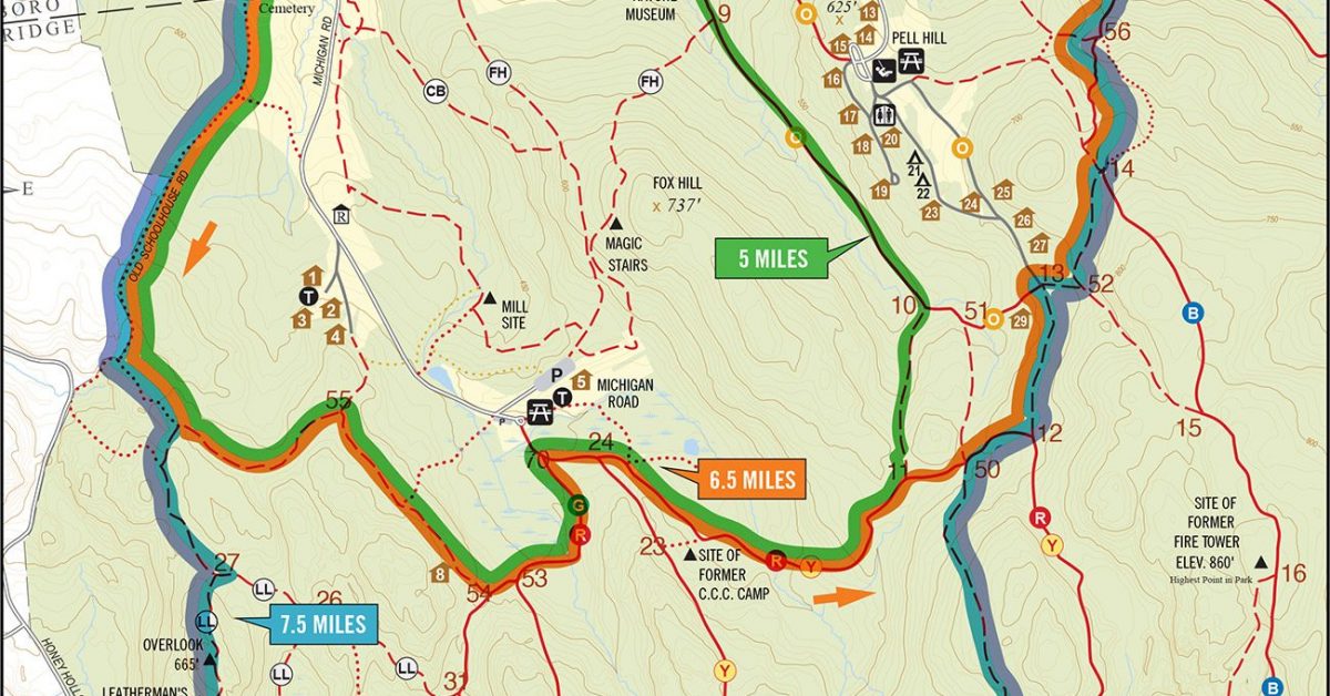
Print Map Download the PDF Trailside Museum to Overlook This course starts at the Trailside Museum and follows FH to the river then makes its way South via Old Schoolhouse […]
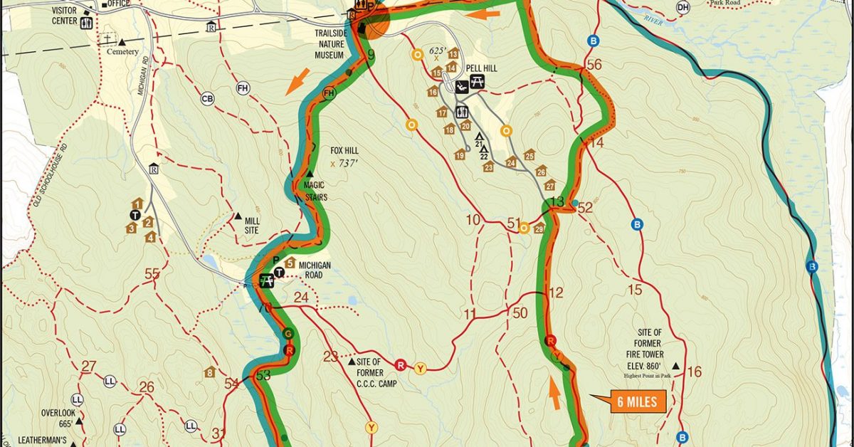
Print Map Download the PDF Trailside, Raven, to Tower 6 Mile Loop This course starts off with a climb up Fox Hill and down to Michigan Road where we make […]
Print Map Download the PDF Museum, Michigan, Raven, & Blue This loop starts over Fox Hill (at 737 feet, one of the highest points in the park) and continues […]
Print Map
Print Map Download the PDF Trailside to Tower 5.8 mile Loop This trail starts at the Trailside Museum and includes the Fire Tower hill and Brown trails, two hills that […]
Print Map Download the PDF Museum to Raven Rocks This route starts at the Trailside Museum and follows the FH trail up and over the Magic Stairs to Michigan Road […]
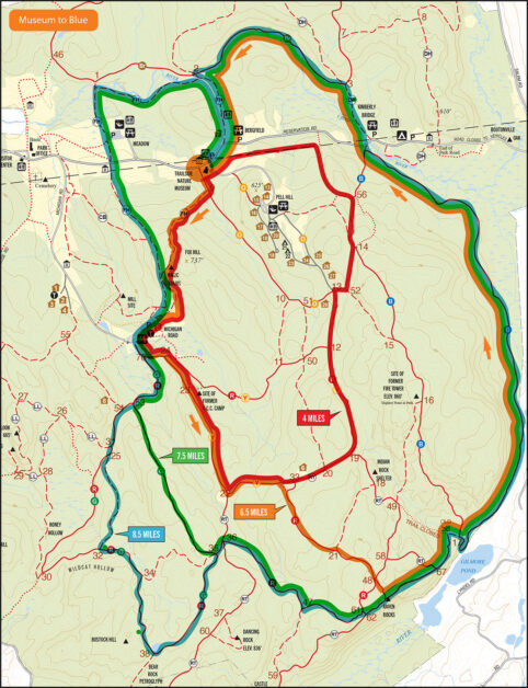
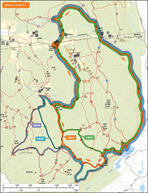
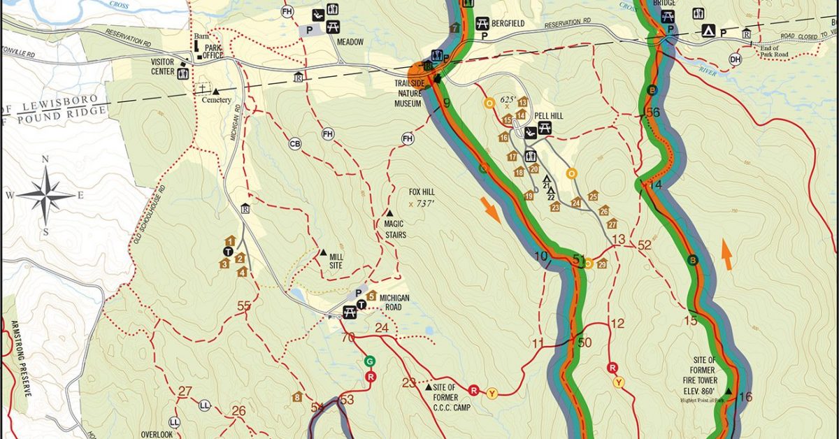
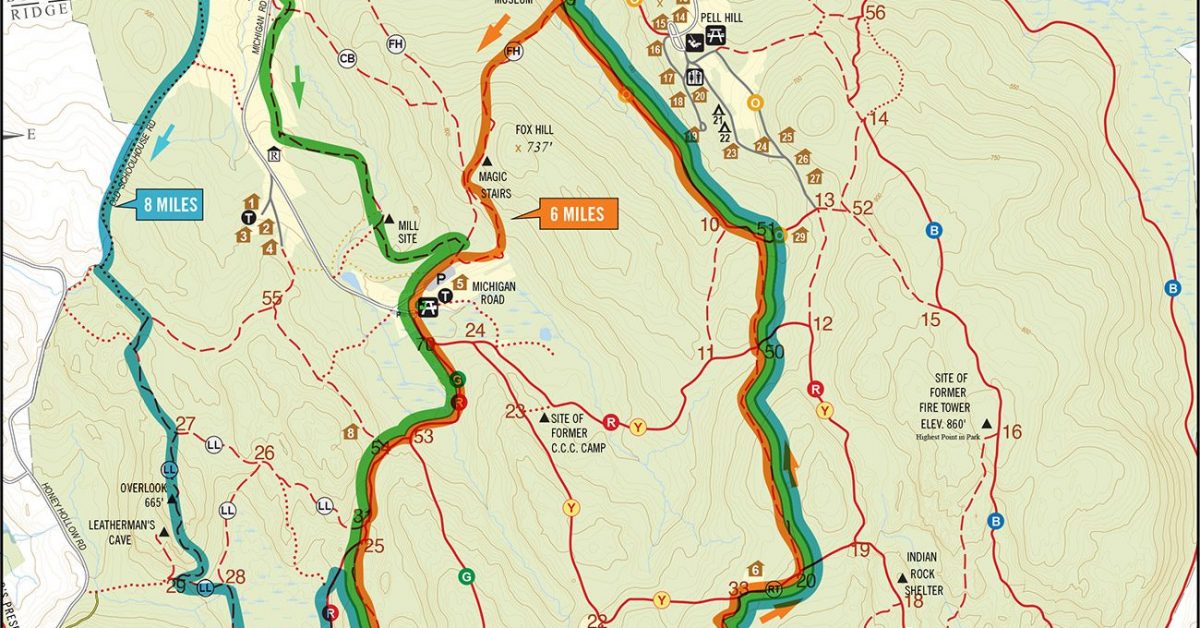
Print Map Download the PDF WPR Museum To Blue Route Start at the Trailside Museum up over the Magic Stairs to Michigan Road. Then into the woods on the RY […]
Print Map Download the PDF WPR Museum to Raven Rocks This route starts at the Trailside Museum and follows the FH trail up and over the Magic Stairs to Michigan […]

View Sunday Run Meeting Places in a larger map
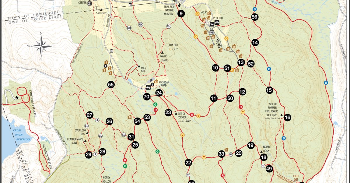
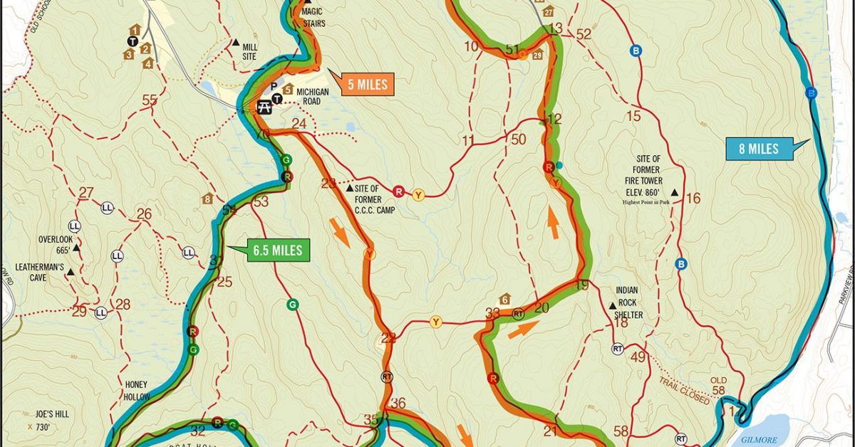
Print Map Download the PDF Run the Numbers This version of the full Ward Pound Ridge Reservation map as enlarged intersection numbers. Choose a series of numbers you want to […]

Print Map Download the PDF Pound Ridge Trail Map Looking to set off on your own course? Use this map to help you find your way. I’ll update this periodically […]