

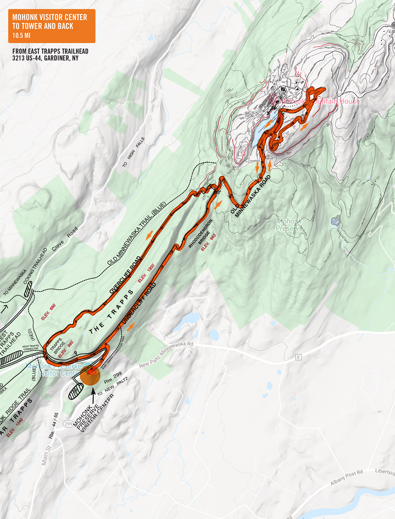
On Saturday, October 24, at 7:00 a.m., meet at the East Trapps Trailhead in Mohonk Preserve, Visitor Center Lot (3213 US-44, Gardiner, NY 12525) ready to run an 11 mile loop through the Mohonk Preserve, by the Mountain House, to Sky Top Tower. Final course is subject to change—we may take the Lemon Squeezer and Labyrinth trail which is always fun. Driving time is approximately 75 minutes from Katonah and parking at the East Trapps lot last year is $20 per person. The foliage should be peak so this should be a spectacular day. If you want to share a ride, meet at the Katonah MTA Woodsbridge lot no later than 5:40.
Can’t get away? Meet at Ward Pound Ridge Reservation, Michigan Road Lot, at 6:00 and 7:00 a.m. and run the classic Michigan to Kimberly Route.
Run Calendar
Mohonk Preserve

WHERE AND WHEN
UPCOMING
Trail Thursday
October 8 @ 5:30 am – 7:00 amAn event every week that begins at 5:30 am on Thursday, repeating indefinitely
Rock Trail Loop
October 10 @ 7:00 am – 9:00 amEleanor’s Escape
October 11 @ 8:00 am – 10:00 amTrail Tuesday
October 13 @ 5:30 am – 7:00 amAn event every week that begins at 5:30 am on Tuesday, repeating until December 29, 2026
Workout Wednesday
October 14 @ 5:30 am – 7:00 amAn event every week that begins at 5:30 am on Wednesday, repeating until December 30, 2026
Trail Thursday
October 15 @ 5:30 am – 7:00 amAn event every week that begins at 5:30 am on Thursday, repeating indefinitely
Butler to Meyer
October 17 @ 7:00 am – 9:00 amGerrython
October 18 @ 8:00 am – 10:00 amTrail Tuesday
October 20 @ 5:30 am – 7:00 amAn event every week that begins at 5:30 am on Tuesday, repeating until December 29, 2026
Workout Wednesday
October 21 @ 5:30 am – 7:00 amAn event every week that begins at 5:30 am on Wednesday, repeating until December 30, 2026
TRAIL DAMAGE REPORT
Help keep the trails clear by reporting downed trees or other conditions that the park should know about.
Report Damage ››
DONATE
STAY ON COURSE
The Free Avenza Maps software now has a free trail map of the Reservation available here. You can use that or the free GaiaGPS to load KML files of some of our runs as overlays. Now there’s no excuse to get lost.

