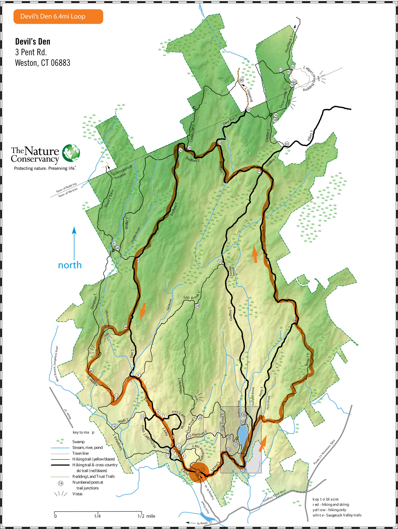
Devil’s Den, Weston, CT
Devil’s Den, Weston, CT
The Lucius Pond Ordway Devil’s Den Preserve in Weston and Redding, Connecticut, encompassing 1,746 acres, is the largest preserve in Fairfield County, Connecticut and one of the larger preserves in the metropolitan New York area. A perimeter loop following the large trails will be approximately 6 miles while following the smaller ones will get you more. Enjoy this unique place.
Upcoming
Sights and Heights
April 5 @ 7:00 am - 8:30 amPound Ridge, NY 10576 United States + Google Map
Meadow to John Jay
April 6 @ 8:00 am - 10:00 amPound Ridge, NY 10576 United States + Google Map
Trail Tuesday
April 8 @ 5:30 am - 7:00 amPound Ridge, NY 10576 United States + Google Map
Workout Wednesday—Trailside Museum
April 9 @ 5:30 am - 7:00 amPound Ridge, NY 10576 United States + Google Map
Trail Thursday
April 10 @ 5:30 am - 7:00 amPound Ridge, NY 10576 United States + Google Map
Museum, CB, to Blue
April 12 @ 7:00 am - 9:00 amPound Ridge, NY 10576 United States + Google Map
Michigan to Kimberly V3
April 13 @ 8:00 am - 9:30 amPound Ridge, NY 10576 United States + Google Map
Trail Tuesday
April 15 @ 5:30 am - 7:00 amPound Ridge, NY 10576 United States + Google Map
Workout Wednesday—Trailside Museum
April 16 @ 5:30 am - 7:00 amPound Ridge, NY 10576 United States + Google Map
Trail Thursday
April 17 @ 5:30 am - 7:00 amPound Ridge, NY 10576 United States + Google Map
Stay On Course
The Free Avenza Maps software now has a free trail map of the Reservation available here. I’ll make .kml files available as I can so you can load them as layer overlays. Now there’s no excuse to get lost.
Donate
Help keep the site running, kick in something for a night run, or help share the cost of special events by donating. Any amount accepted. Thanks.
Donate with Venmo ››
