No products in the cart.

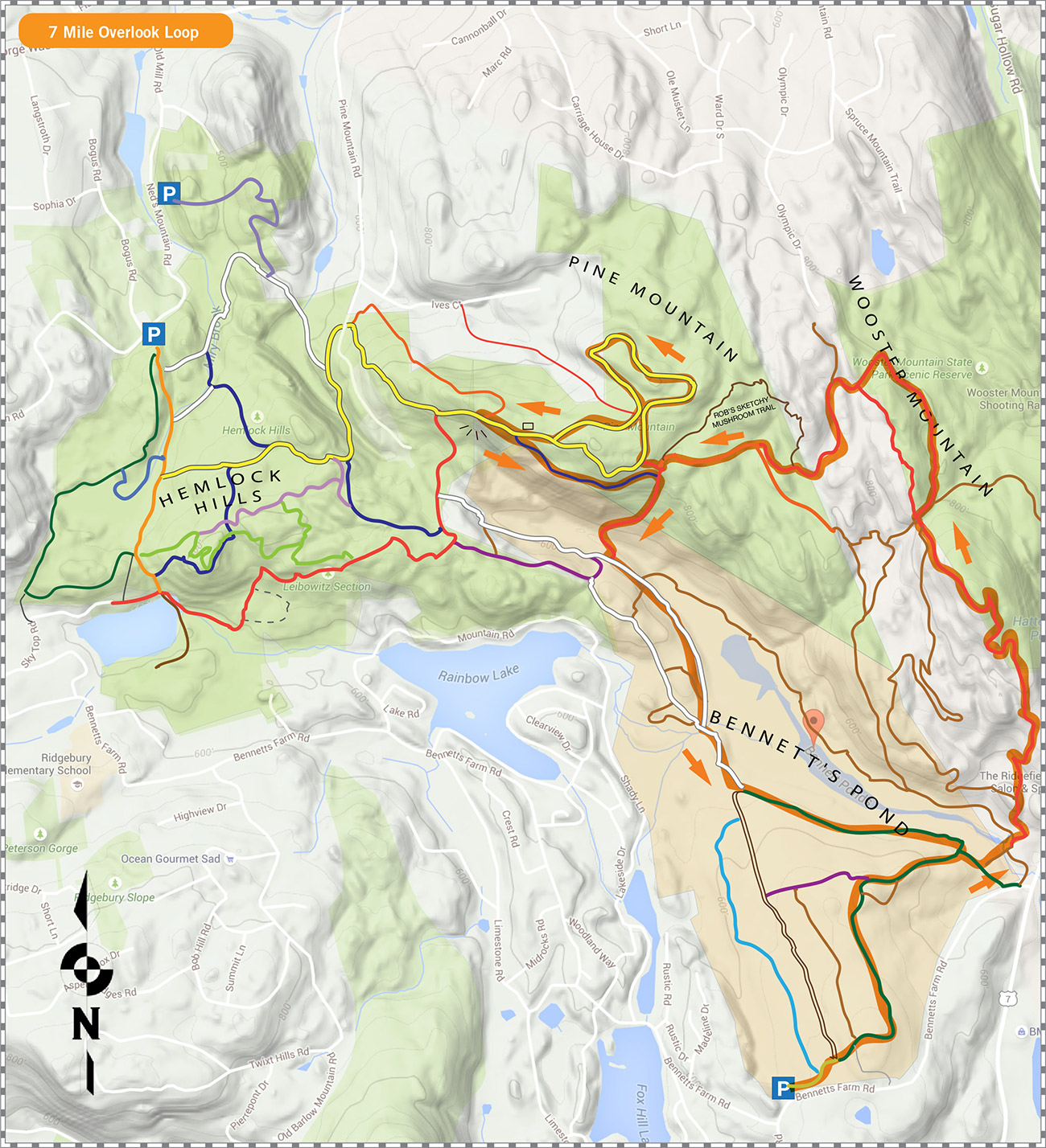
Bennett’s Pond 7Mi Overlook Loop
This 7 mile loop starts at the lot on Bennett’s Farm Road and heads in a counterclockwise loop around the pon, up Wooster Mountain, to the overlook. Then it doubles back to the new ridge trial (blue) and down the steep red trail before returning on some of the easiest trails in the park. A great mix of technical and easy makes this a great run.
Upcoming
Trail Tuesday

Ward Pound Ridge Reservation, Michigan Road Lot
Michigan Road
Pound Ridge, NY 10576 United States + Google Map
Pound Ridge, NY 10576 United States + Google Map
Workout Wednesday—Trailside Museum

Trailside Museum
Reservation Road
Pound Ridge, NY 10576 United States + Google Map
Pound Ridge, NY 10576 United States + Google Map
Trail Thursday

Ward Pound Ridge Reservation, Michigan Road Lot
Michigan Road
Pound Ridge, NY 10576 United States + Google Map
Pound Ridge, NY 10576 United States + Google Map
Run the Numbers Part 4

Ward Pound Ridge Reservation, Michigan Road Lot
Michigan Road
Pound Ridge, NY 10576 United States + Google Map
Pound Ridge, NY 10576 United States + Google Map
Mudders & Grunters or Trailside & Town Park

Trailside Museum
Reservation Road
Pound Ridge, NY 10576 United States + Google Map
Pound Ridge, NY 10576 United States + Google Map
Trail Tuesday
Ward Pound Ridge Reservation, Michigan Road Lot
Michigan Road
Pound Ridge, NY 10576 United States + Google Map
Pound Ridge, NY 10576 United States + Google Map
Workout Wednesday—Trailside Museum
Trailside Museum
Reservation Road
Pound Ridge, NY 10576 United States + Google Map
Pound Ridge, NY 10576 United States + Google Map
Trail Thursday
Ward Pound Ridge Reservation, Michigan Road Lot
Michigan Road
Pound Ridge, NY 10576 United States + Google Map
Pound Ridge, NY 10576 United States + Google Map
Red/Rock Trail Loop

Ward Pound Ridge Reservation, Michigan Road Lot
Michigan Road
Pound Ridge, NY 10576 United States + Google Map
Pound Ridge, NY 10576 United States + Google Map
Trail Tuesday
Ward Pound Ridge Reservation, Michigan Road Lot
Michigan Road
Pound Ridge, NY 10576 United States + Google Map
Pound Ridge, NY 10576 United States + Google Map