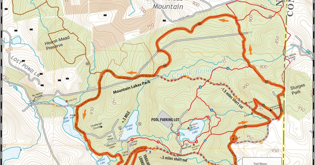
Mountain Lakes/Old Sib/Hearst
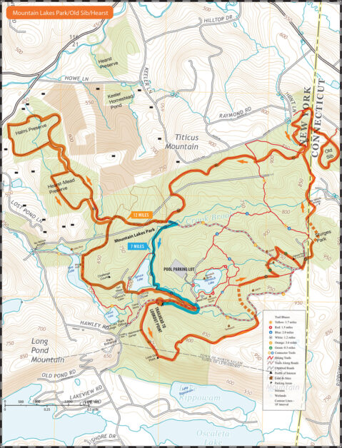
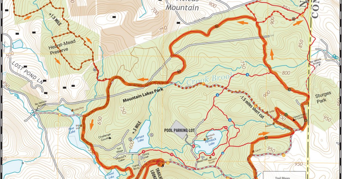
Print Map Download the PDF KML File GPX File Mountain Lakes Park / Old Sib / Hearst This takes our traditional Mountain Lakes park run and adds the adjacent Old […]

Print Map Download the PDF KML File GPX File Mountain Lakes Park / Old Sib / Hearst This takes our traditional Mountain Lakes park run and adds the adjacent Old […]
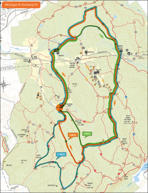
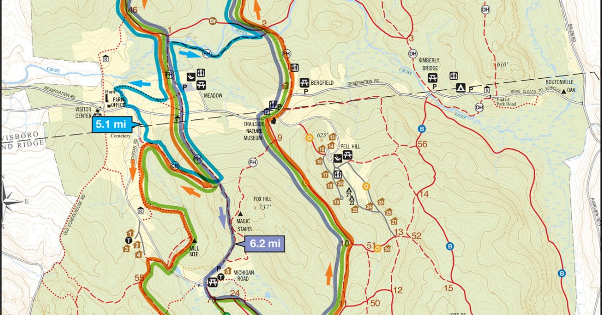
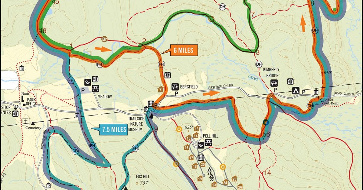
Print Map Download the PDF Michigan Road to Kimberly Bridge V3 This run starts at Michigan Road and offers three courses that pass through Kimberly Bridge and up Blue.
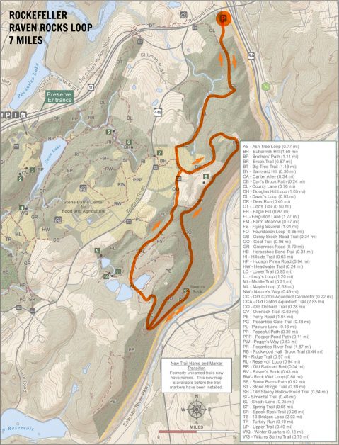
Print Map Download the PDF KML File GPX File Rockies Raven Route 7 miles There’s more than one Raven’s Rock in Westchester and this run has that as the destination. […]
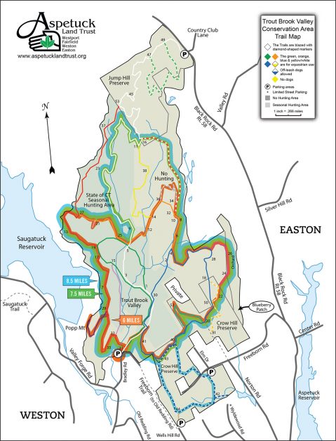
Print Map Download the PDF Trout Brook Valley A pristine landscape with nearly 14 miles of trails, ranging from easy to difficult. The trails take the hiker past dramatic displays […]
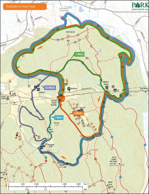
Print Map Download the PDF Trailside to Town Park This course offers runners different distances starting at the Trailside Nature Museum and heading toward Lewisboro Town Park. Options include a […]
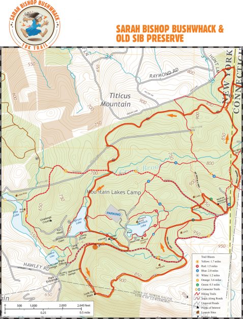
Print Map Download the PDF Sarah Bishop and Old Sib This course combines the most recent Sarah Bishop course with an excursion to Old Sib at the very northern part […]
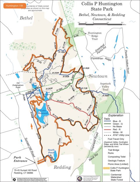
Print Map Download the PDF Huntington State Park 15k This perimeter loop of Huntington State Park in Redding, Connecticut, includes a variety of wooded terrain. Those looking for something more […]
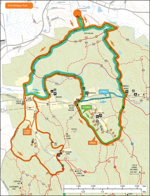
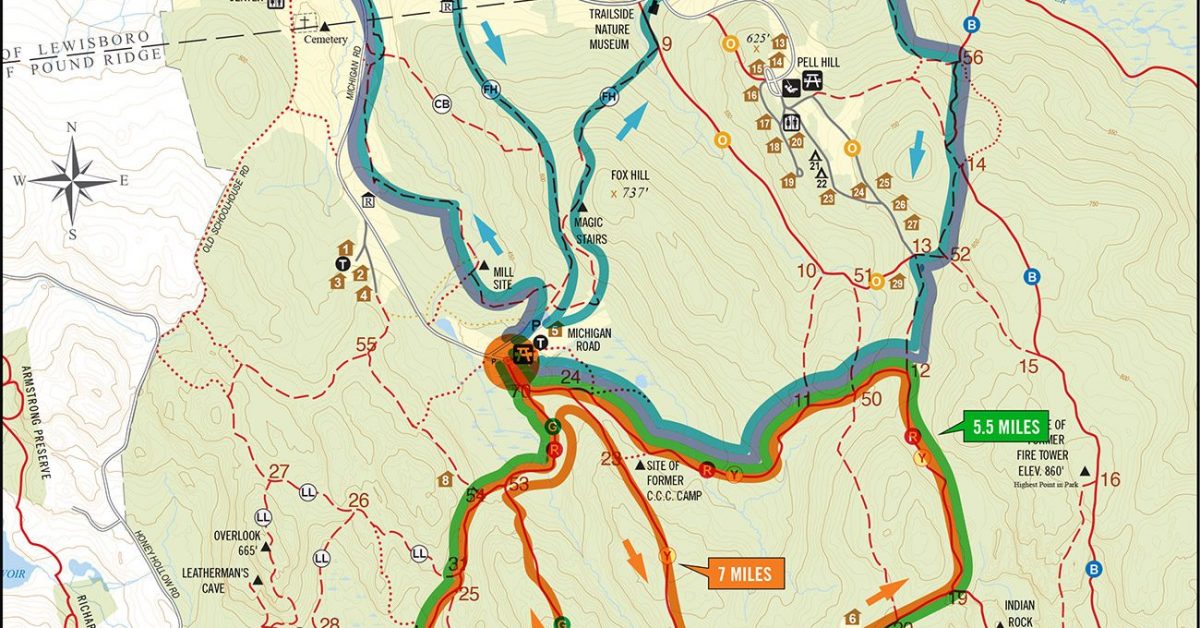
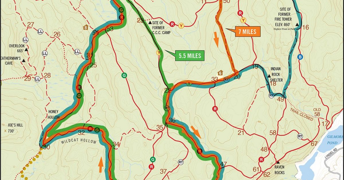
Print Map Download the PDF Five Bridges Run The Five Bridges Run gets its name from the course that passes over five bridges in Ward Pound Ridge Reservation—Old Schoolhouse Road […]
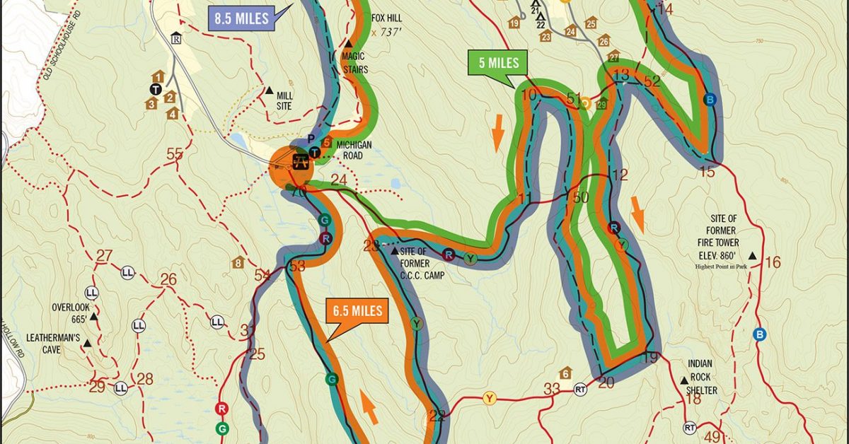
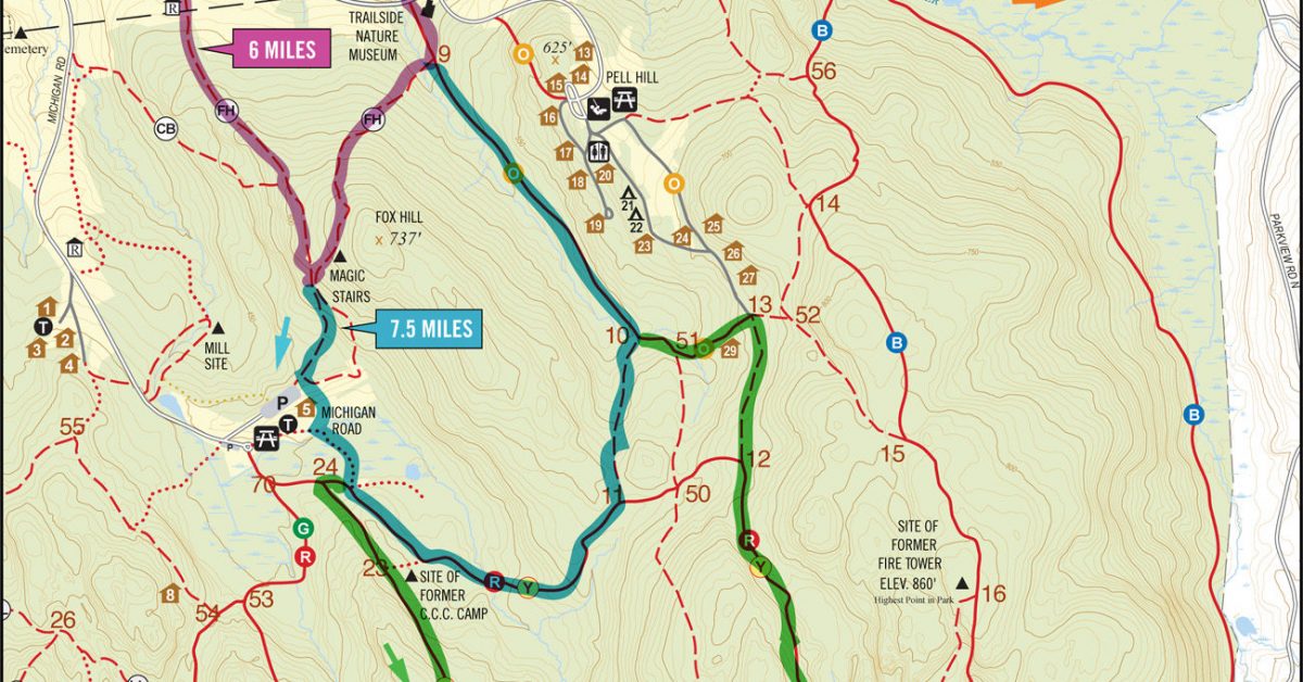
Print Map Download the PDF Michigan Zig Zags This course is designed to test your mapping abilities. While it’s not complicated, it does require runners to keep on their toes […]
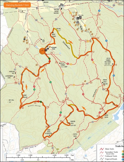
Print Map Download the PDF Dancing Rockish 7.5mi This course follows many of the trails of the Dancing Rock Run without following most of the bushwhacks. As such, it’s a […]
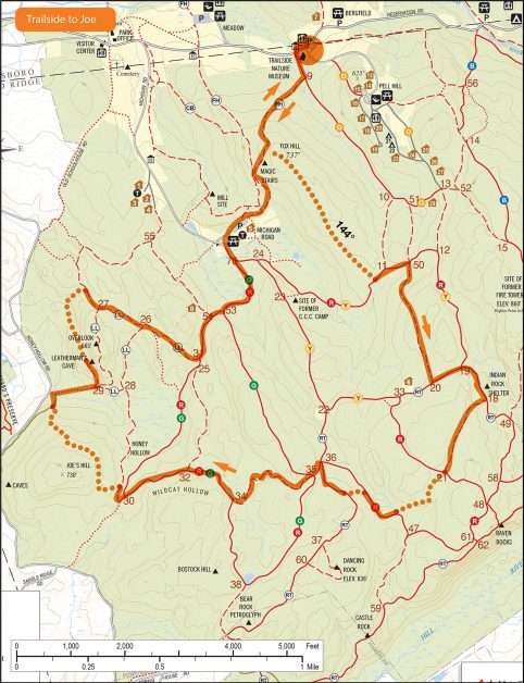
Print Map Download the PDF TRAILSIDE TO JOE 7 Miles This seven-mile course starts at the Trailside Museum and includes three Bushwhacks. Intrepid runners can bring a compass and navigate […]

Print Map Download the PDF ANNUNAKI BUSHWHACK The Annunaki Bushwhack is a multi-distance run that includes a steep bushwhack to reach the Annunaki near Blue then through the forest to […]
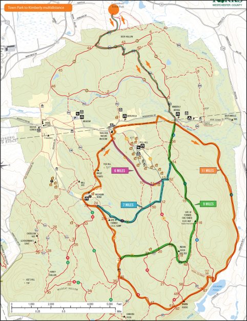
Print Map Download the PDF Lewisboro Town Park to Kimberly Multidistance Loops This course starts at Lewisboro Town Park and makes its way to Kimberly Bridge. From there, runners have […]
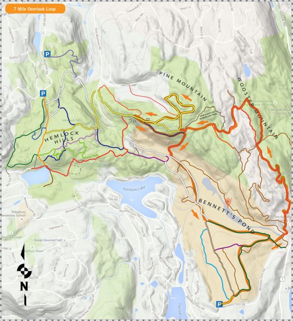
Print Map Download the PDF Bennett’s Pond 7Mi Overlook Loop This 7 mile loop starts at the lot on Bennett’s Farm Road and heads in a counterclockwise loop around the […]
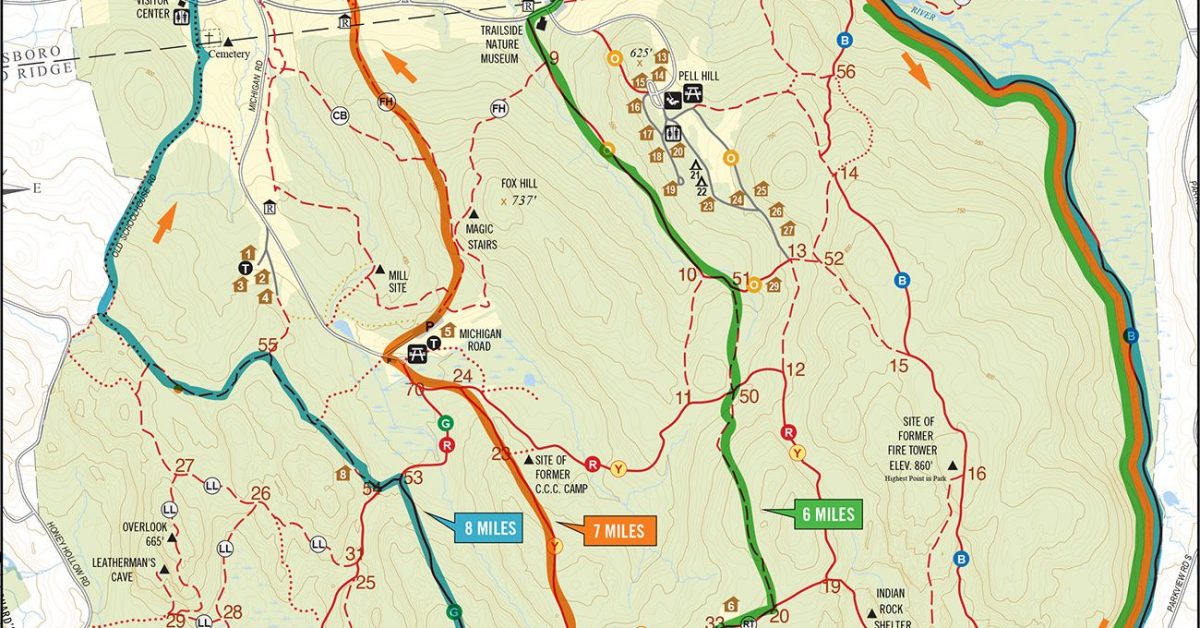
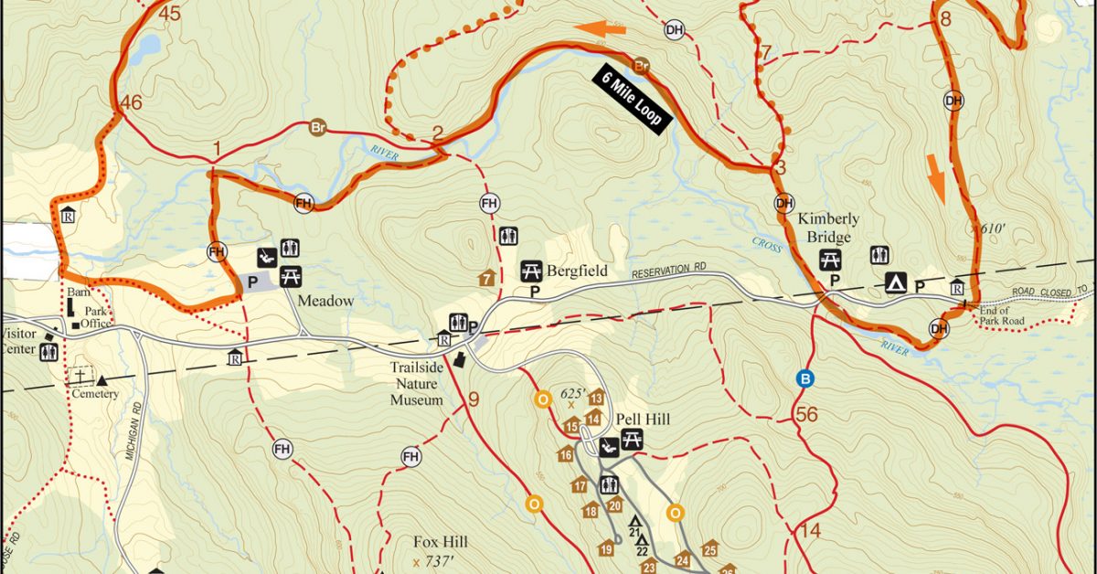
Print Map Download the PDF Trailside to Green 6mi/8mi Loop This course starts at the Trailside Museum and makes a loop up Blue, down Green, up FH, and down CB. […]
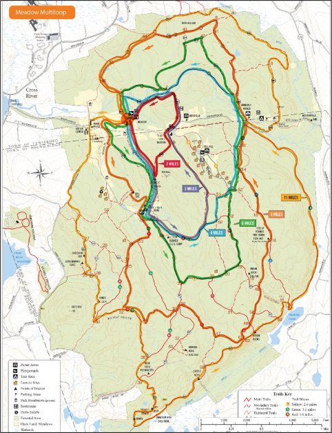
Print Map Download the PDF Meadow Multiloop Designed as a great training run for that ultra you signed up for, I suggest running this starting with the outermost loop and […]

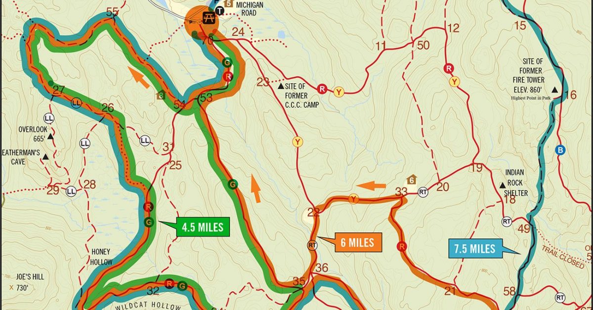
Print Map Download the PDF Michigan to Clark 7.5 mile run This run will get you off the reservation—literally. Start at Michigan road and head south on the Rock Trail. […]
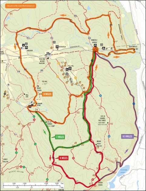
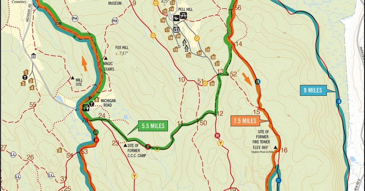
Print Map Download the PDF Boutonville Oak Multidistance This course offers runners a chance to see the Boutonville Oak, a storied landmark on the eastern side of the reservation. Distances […]

Print Map Download the PDF KMA to Hunt/Parker 7 mile run This is a great alternative to running the KMA to Upper Hook Road run since it gives runners the […]
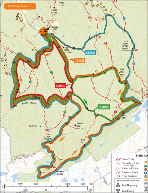
Print Map Download the PDF WPR Rock Trail 7.5mi One of the newer and more challenging trails in the reservation starts from the Michigan Road lot and passes the Indian […]
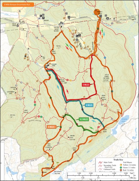
Print Map Download the PDF Bosque Encantado 8-Mile Run The Bosque Encantado is an area around a knoll just off the Blue trail between intersections 13 and 14. The knoll […]
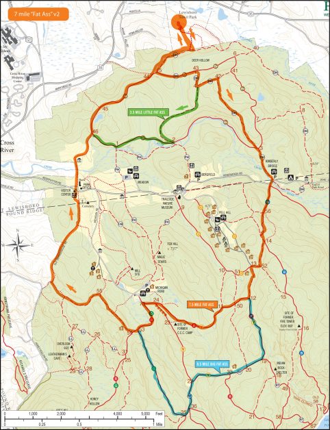
Print Map Download the PDF Fat Ass V3 This version of our perennial favorite Fat Ass run starts at Lewisboro Town Park but avoids the bridge at intersection 2. While […]
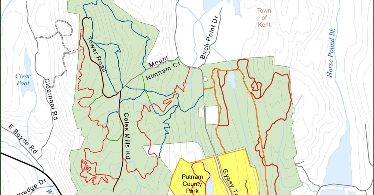
Print Map Download the PDF Nimham Mountain Ninham Mountain (parking at 5 Mt. Nimham Court, Carmel, NY) offers hiking and biking trails and great views from the Nimham Fire Tower […]
Print Map Download the PDF Michigan Road Double This course is perfect if you’re looking to get some mileage on the fast, larger trails in the south. Head out on […]
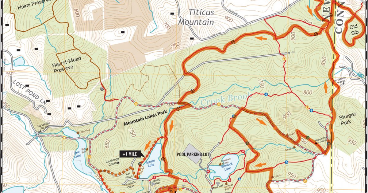
Print Map Download the PDF Mountain Lakes Park Old Sib Run This takes our traditional Mountain Lakes park run and adds and adjacent new preserve—the Old Sib preserve. While small, […]
Print Map Download the PDF Boutonville Oak Multidistance Loop This course starts at Kimberly Bridge then heads East where it crosses the road then takes a brief out-and-back to the […]
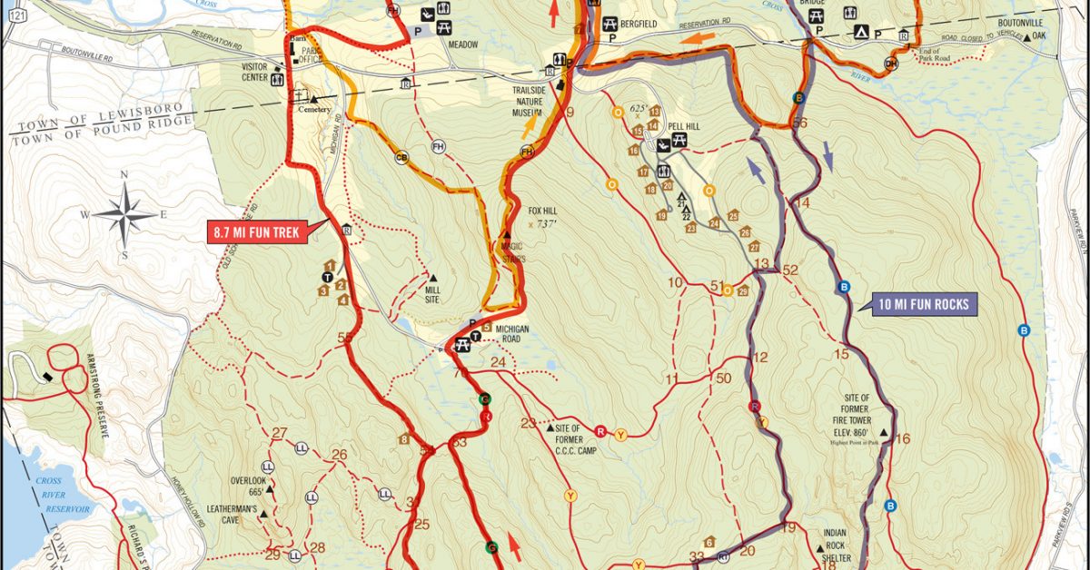
Print Map Download the PDF Peeter’s Ultra Fun Multi-distance Loops This series of loops by Peeter Muursepp were created with one goal in mind—take advantage of a Strava Segment called […]
Print Map Download the PDF Blue Mountain 7 Mile Double Loop This course begins in the parking lot past the great lodge at blue mountain. The first loop is a […]
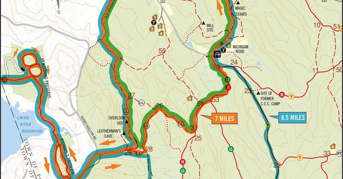
Print Map Download the PDF Meadow to Armstrong Loop This course starts at the Ward Pound Ridge Meadow Lot and winds its way toward Honey Hollow Road where it crosses […]
Print Map Download the PDF SARAH BISHOP BUSHWHACK 2017 This updated course map shows a new twist on the classic curse at the northern corner of the park. A new […]
Print Map Download the PDF Michigan to Spy Rock “Stairmaster” This loops starts with a significant climb up the FH trail and over the Magic Stairs. Then you’ll head to […]
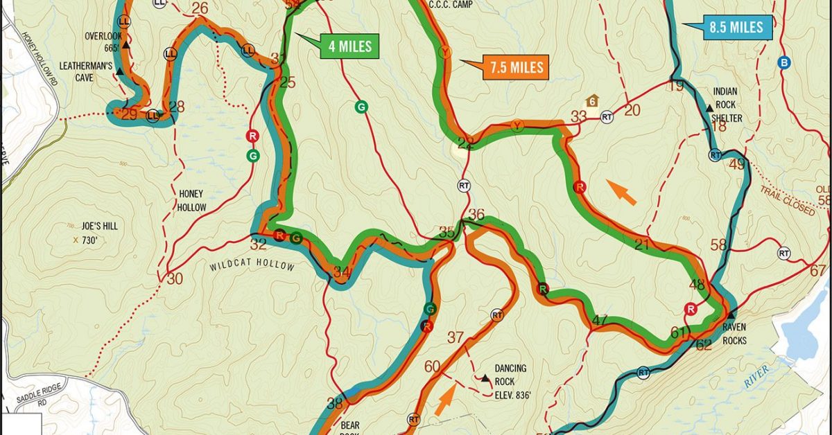
Print Map Download the PDF Sights & Heights Loop, version 2 This version of the Sights & Heights loop takes runners to the Overlook Dancing Rock, Raven Rocks, and the […]
Print Map Download the PDF Kimberly Bridge to Raven Rocks Run This course starts out on the beautiful Blue trail which lulls you into a sense of accomplishment before hitting […]

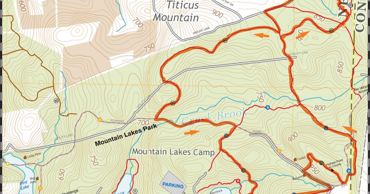
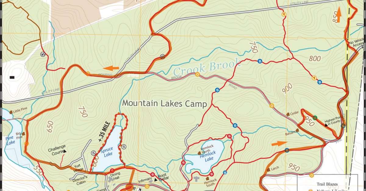
Print Map Download the PDF Mountain Lakes Park 6.5 Mile Yellow OS IS Loop This course starts at the Trailhead to Lookout Point and winds its way along the blue […]
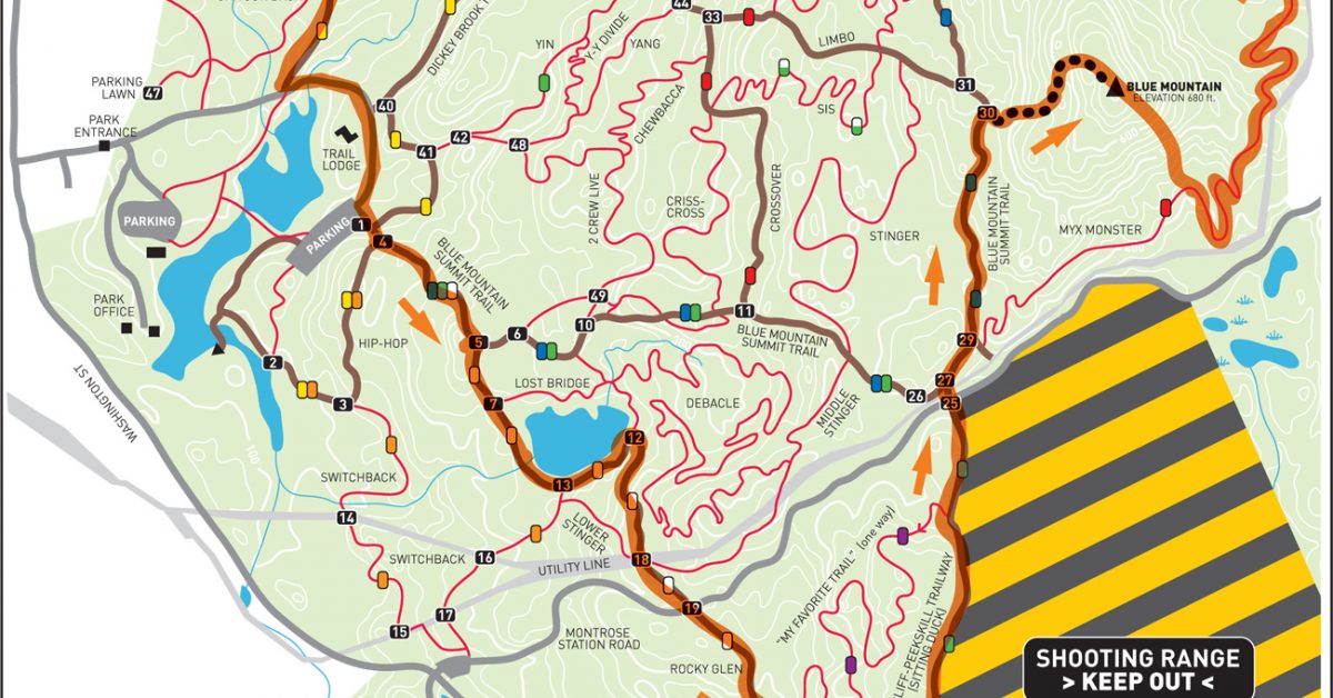
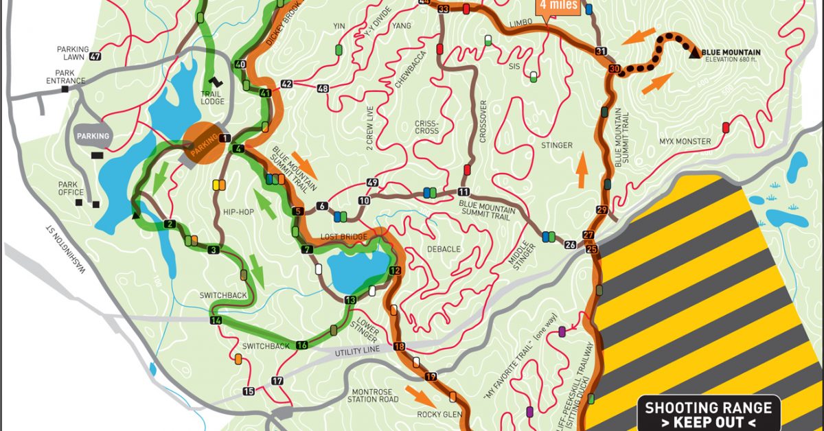
Print Map Download the PDF Blue Mountain Perimeter 7 Mile Loop This course contains the perimeter trails at Blue Mountain and includes a climb up and over Blue Mountain itself. […]
Print Map Download the PDF Graham Hills Perimeter Loop Graham Hills is a multi-use park in Pleasantville that contains a variety of trails. The 7-mile perimeter loop is just one […]
Print Map Download the PDF Blue-Per Bowl 7.3 Mile Loop This looped course starts at Depew Court entrance to Blue Mountain and follows most of the perimeter trails around the […]

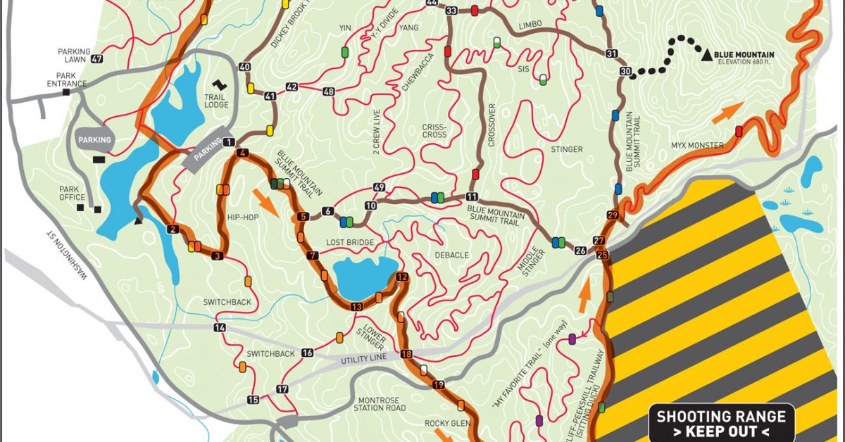
Print Map Download the PDF Blue Mountain Twin Peaks 7.7 Mile Run Located in Peekskill (Cortlandt), New York, Blue Mountain Reservation is a 1,538-acre park in the northwest section of […]
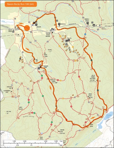
Print Map Download the PDF Download the KML Download the GPX Raven Rocks Run 10K This run starts in the Meadow near where the Leatherman’s Loop begins but in the […]
Print Map Download the PDF Town Park to Covered Bridge Multidistance Run This run starts at the Lewisboro Town Park and heads into the Reservation, through the Meadow lot, up […]

Print Map Download the PDF Sylvan Glen/Granite Knolls Park 10K Tucked away on a hillside in northern Westchester County, NY, Sylvan Glen Nature Preserve is the site of a former […]
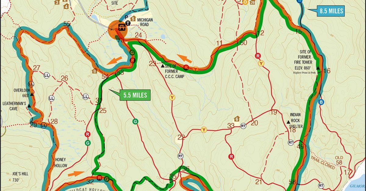
Print Map Mountain Lakes Park Larch Loop This 5.5-mile loop starts at Larch Campsite, a mile into the camp from the Park Office. The full course is 5.5 miles […]
Print Map Download the PDF Mountain Lakes Park Perimeter Loop This perimeter loop starts at the trailhead to Lookout Point and follows the white trail up to the overlook. […]
Print Map Download the PDF Town Park Northern Loop This course starts at the Lewisboro Town Park and makes a counterclockwise loop through the Ward Pound Ridge Reservation (mostly) northern […]
Print Map Download the PDF Michigan Red/Rock v2 This course gives you plenty of options. The main route follows the LL to Red trail from Michigan Road before arriving at […]
Print Map Download the PDF 6/7 Mile Inaugural Loop from Town Park This is the run that started it all in spring of 2010. A few local runners got together […]
Print Map Download the PDF Mountain Lakes Park Perimeter Loop This course begins on the White trail and includes the outlying portions of the park with one diversion over Mount […]
Print Map Download the PDF Red and Green Loop We’ll start out on the Red Green trail and make a loop toward the Leatherman’s Loop trail (watch for the small […]