Leon Levy Preserve

Print Map Download the PDF Leon Levy Preserve The Leon Levy Preserve is located on Route 123 in South Salem (24 Smith Ridge Road, South Salem). The map above shows […]

Print Map Download the PDF Leon Levy Preserve The Leon Levy Preserve is located on Route 123 in South Salem (24 Smith Ridge Road, South Salem). The map above shows […]
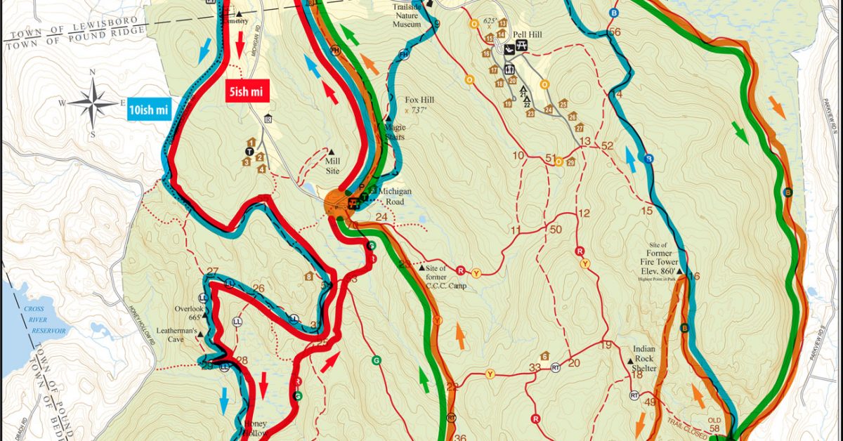
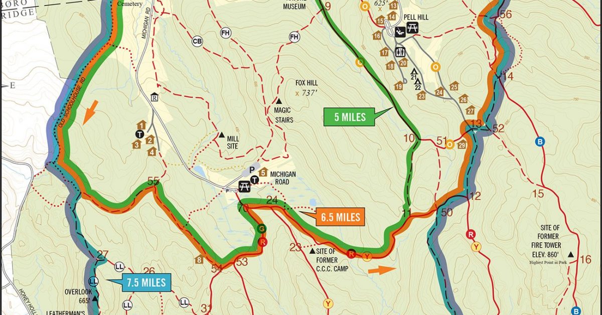
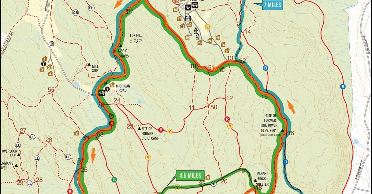
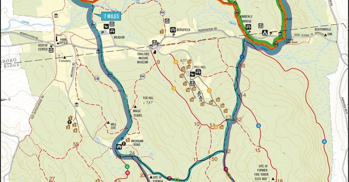
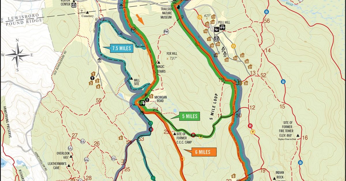
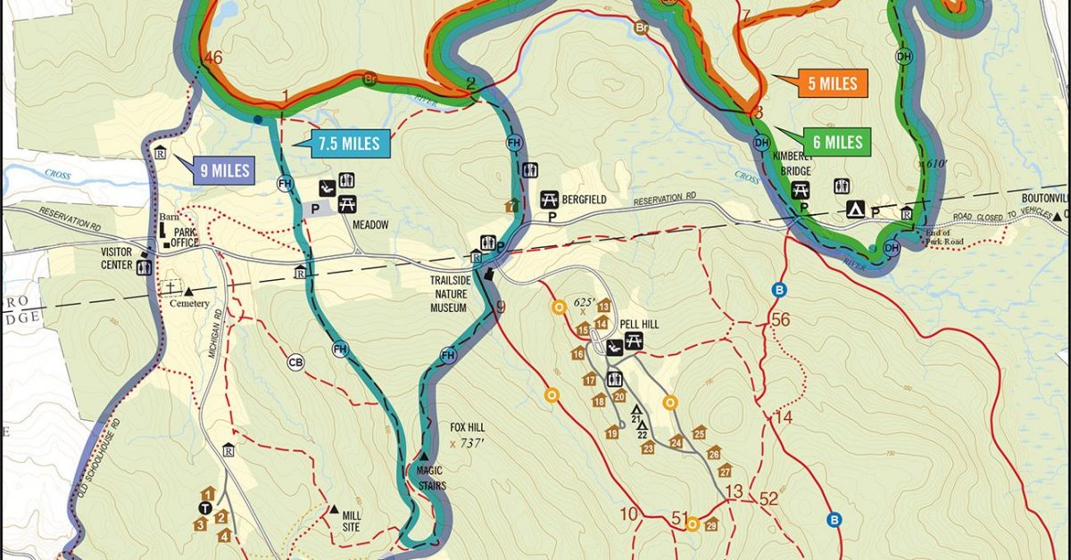
Print Map Download the PDF Michigan Gerrython This multi-distance run is inspired by Gerry Sullivan and includes options for 5, 7, 10, and 13 miles. Combine two or more and […]
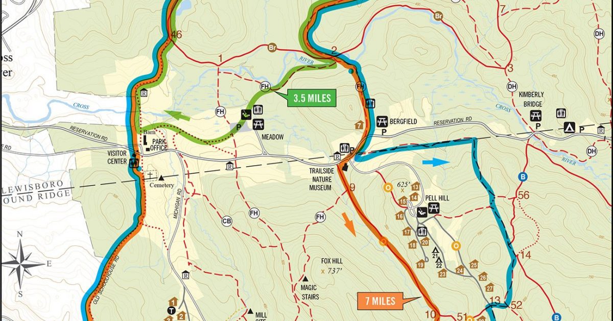
Print Map Download the PDF Meadow to Overlook Loop v2 This course starts at the Meadow Parking Lot and heads to the Overlook. The course splits into differen tdistances, returning […]
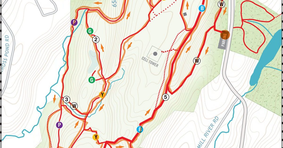
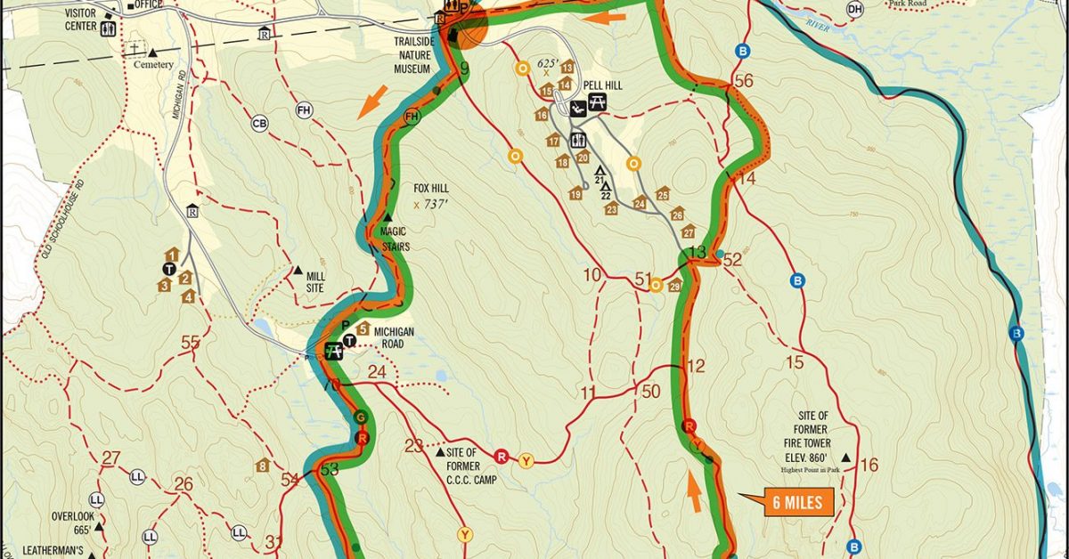
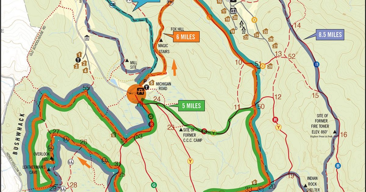
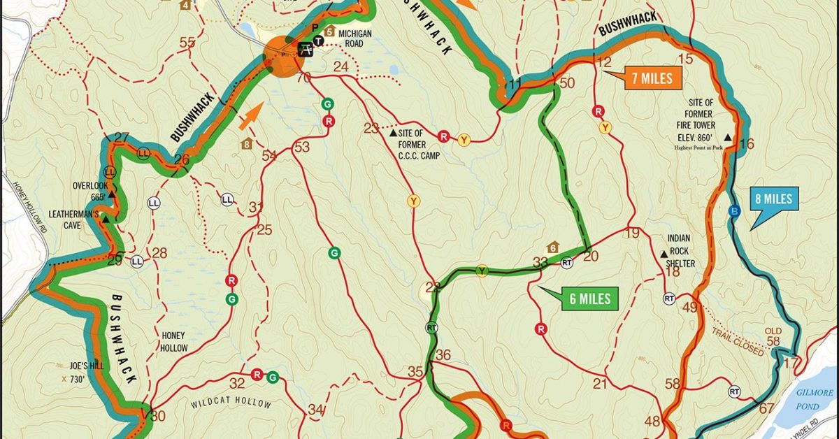
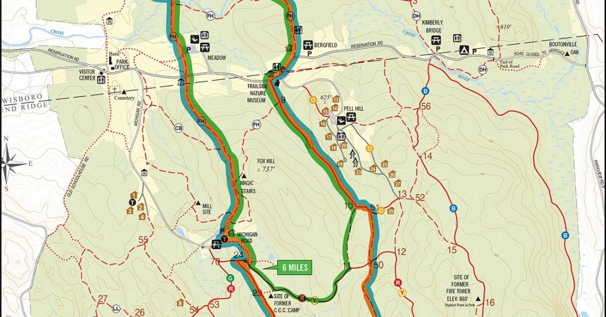
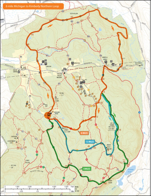
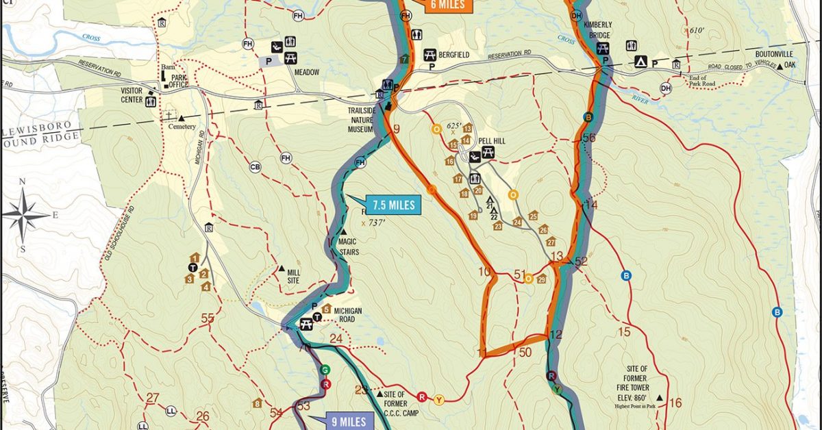
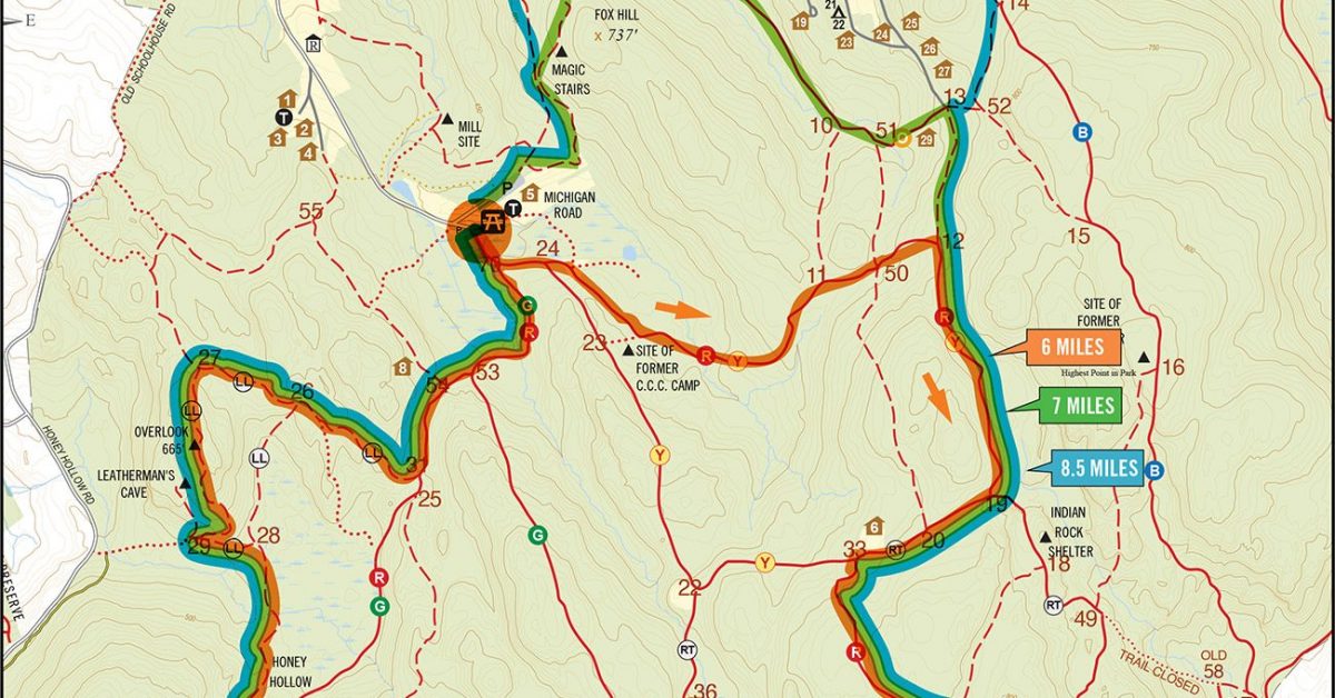
Print Map Download the PDF Leon Levy Preserve 6 Mile Run While this might look to some like a plate of spaghetti, it’s actually a great trail run in the […]
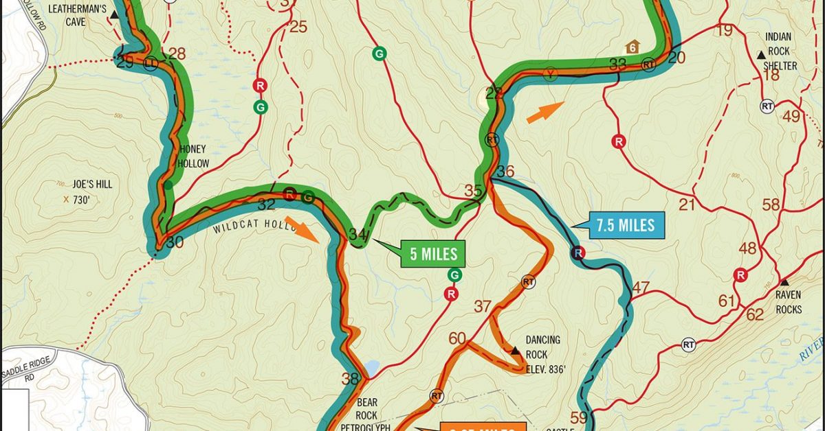
Print Map Download the PDF Fire Tower Summit v2 This is the third variation of the Fire Tower run and undoubtedly the best. Start in the Meadow where the Leatherman’s […]
Print Map Download the PDF Trailside Museum to Overlook This course starts at the Trailside Museum and follows FH to the river then makes its way South via Old Schoolhouse […]
Print Map Download the PDF Sights and Heights v1 This course takes you from the Michigan Road Lot to the Overlook and Raven Rocks for two of the best sights […]
Print Map Download the PDF Rock Trail Loop v2 This is an update to the classic, but shorter, Rock Trail loop. In this version, start at Michigan Road and follow […]
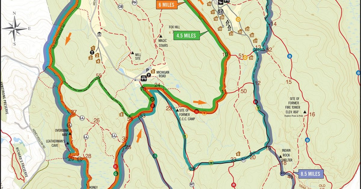
Print Map Download the PDF Meadow, Museum, Fire Tower to Michigan Loop From the Meadow parking lot, make your way to the Trailside Museum via the FH trail. Cross the […]
Print Map Download the PDF Trailside, Raven, to Tower 6 Mile Loop This course starts off with a climb up Fox Hill and down to Michigan Road where we make […]
Print Map Download the PDF Town Park Northern Loop v2 This loop starts at the Lewisboro Town Park and follows the DH and brown trails to Kimberly Bridge before continuing […]
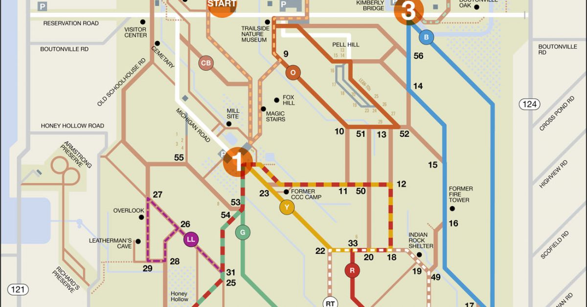
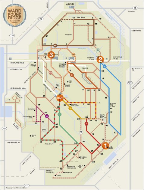
Print Map Download the PDF Reservation Subway Series 1, Meadow Start This run swaps the traditional reservation map for a more stylized map and gives runners the opportunity to make […]
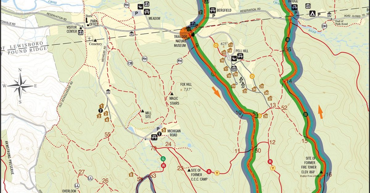
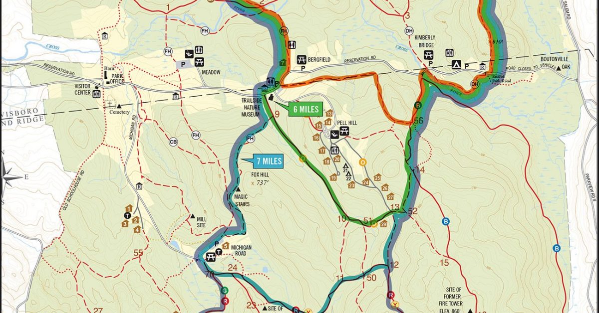
Print Map Download the PDF Museum, Michigan, Raven, & Blue This loop starts over Fox Hill (at 737 feet, one of the highest points in the park) and continues […]
Print Map Download the PDF Blue Moon Trail This course takes includes some bushwhacking so do yourself a favor and bring a map with you. Start at Michigan Road and […]
Print Map Download the PDF Green / Rock Trail 6.5 mile loop This course starts out on the beautiful Green trail before turning onto the more technical Rock Trail where […]
Print Map

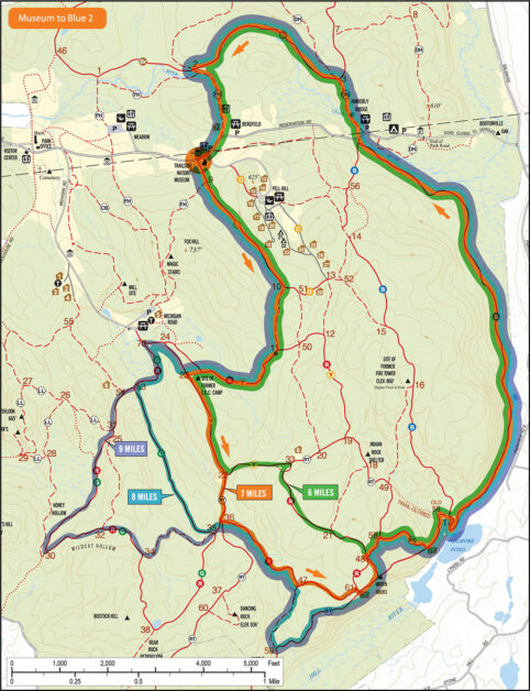
Print Map Download the PDF Meadow to Overlook Loop This course starts at the Meadow Parking Lot and follows the FH trail to the trailside museum where we’ll pass the […]
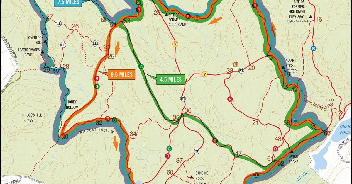
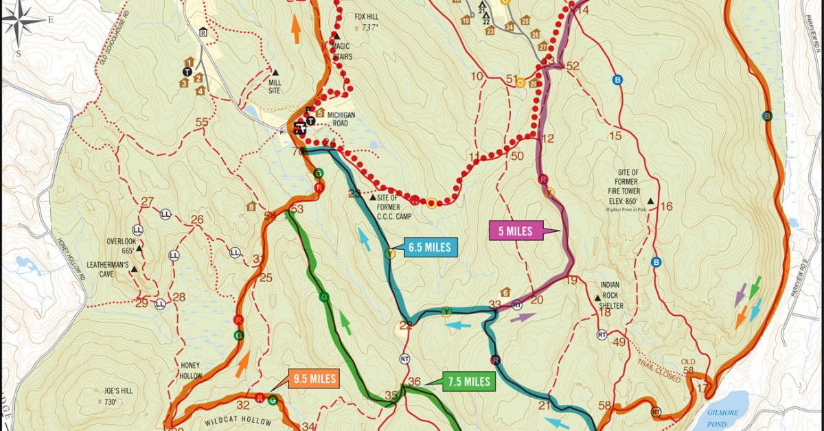
Print Map Download the PDF Download the KML file ›› Eleanor’s Escape 7.5 Mile Loop Named for Eleanor Heppner Hershey who recommended this great run that combines the best of […]
Print Map Download the PDF Dave Cope/Tony Godino Bushwhack Bonanza The name says it all. Trails, no trails, streams, rocks, mud, gnar, and fun. Similar to the Dancing Rock Run […]
Print Map Download the PDF 6.15 mi Meadow, Michigan, and Museum Loop This 6.15 mile loop heads south from the Meadow lot over Fox Hill to the Michigan Road lot […]
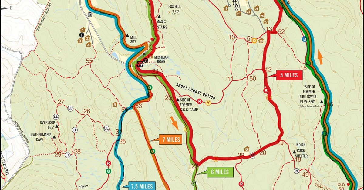
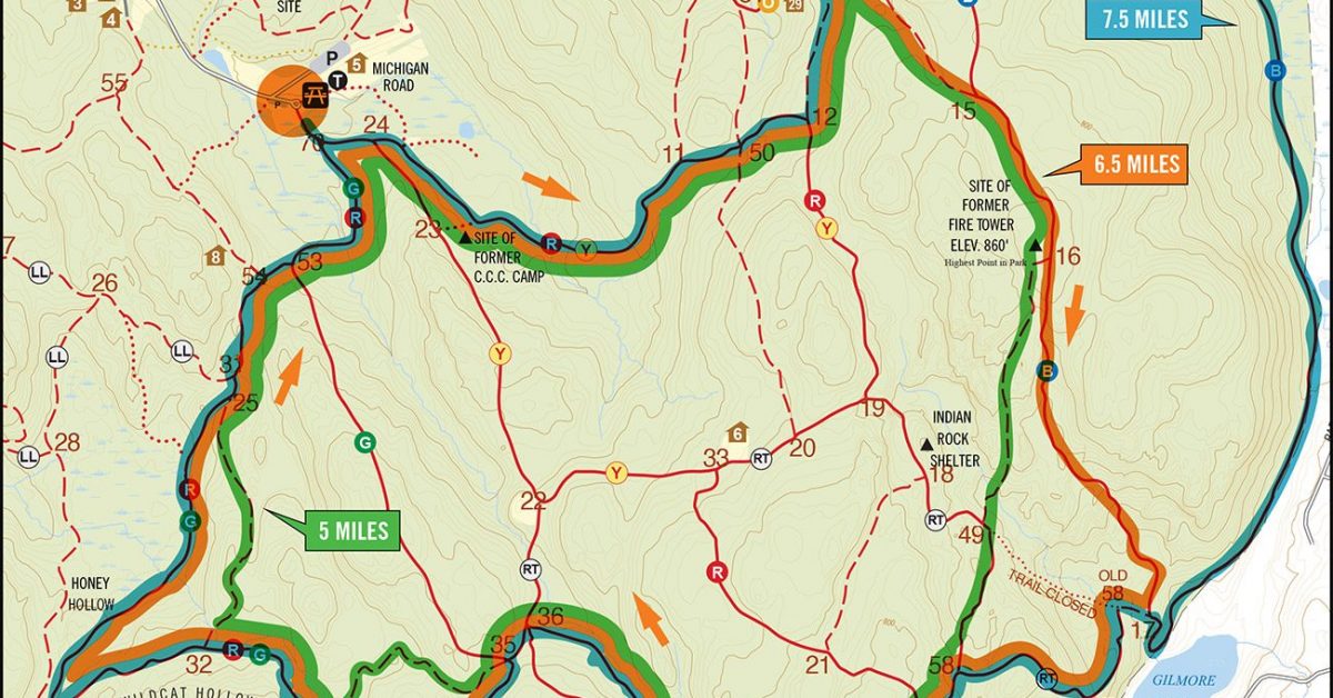
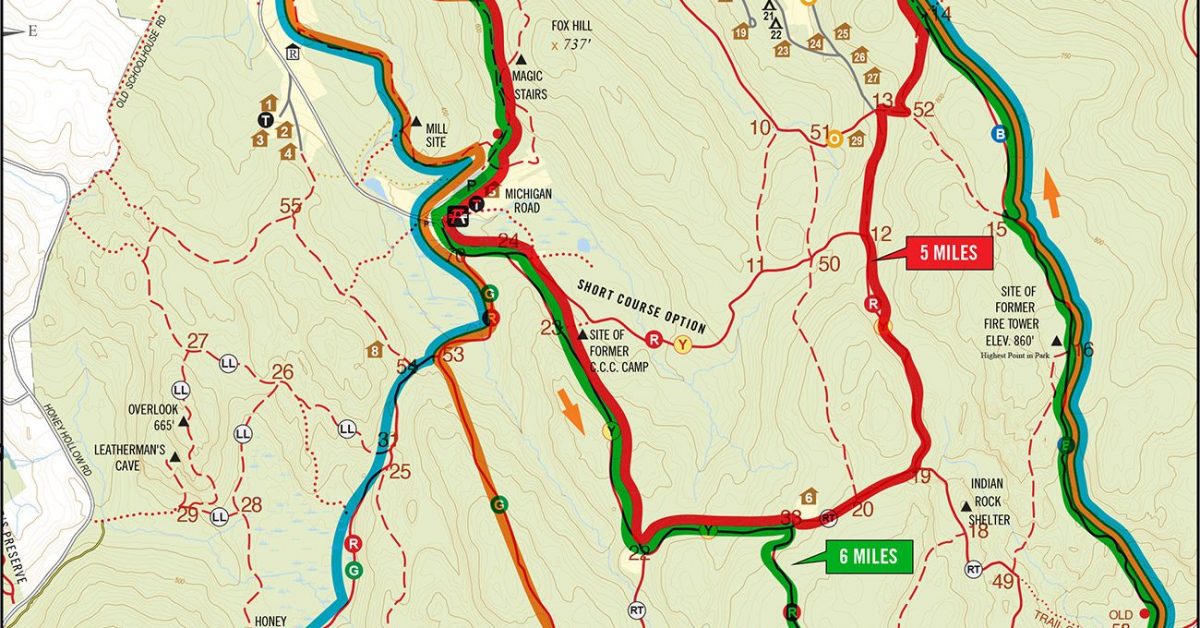
Print Map Download the PDF Trailside to Tower 5.8 mile Loop This trail starts at the Trailside Museum and includes the Fire Tower hill and Brown trails, two hills that […]
Print Map Download the PDF Town to Tower 7.3 mi Loop This trail starts at the Lewisboro Town Park and includes a hill at the start, another before the Trailside […]
Print Map Download the PDF Town to Michigan 6.8 mi / 1,583 ft Elevation Gain If you started in the Lewisboro Town Park and wanted to run, say, six miles, […]
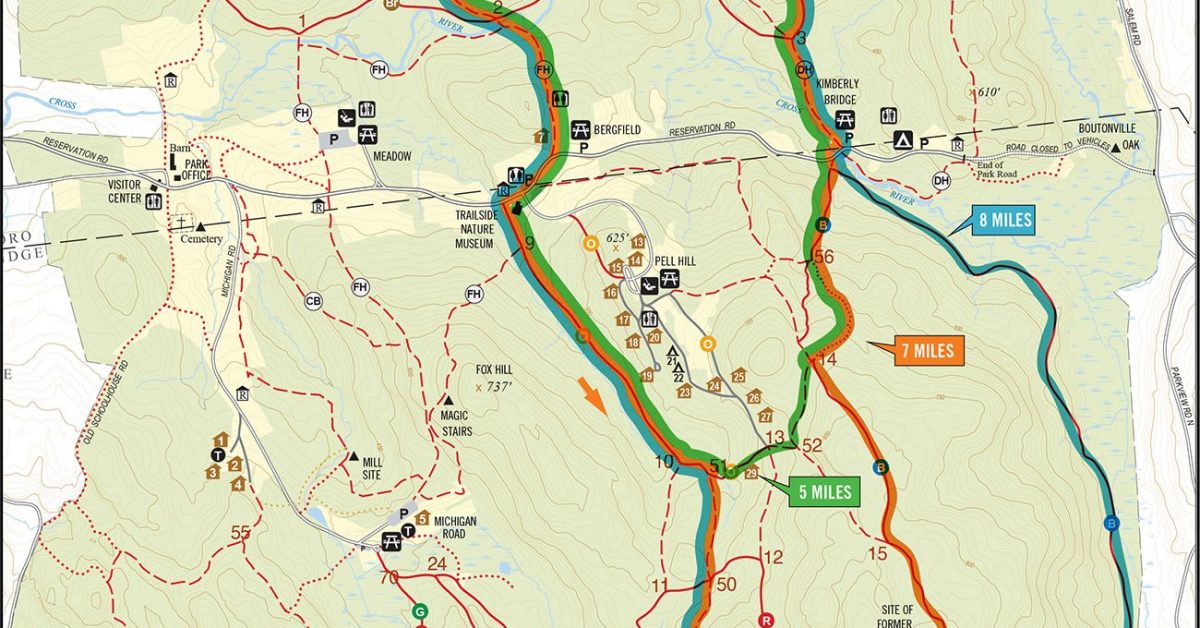
Print Map Download the PDF Michigan Road to Kimberly Bridge 6 Mile Loop Meet at Michigan Road for a 6 mile loop that takes us around the Northern portion of […]
Print Map Download the PDF Museum to Raven Rocks This route starts at the Trailside Museum and follows the FH trail up and over the Magic Stairs to Michigan Road […]
Print Map Download the PDF Michigan to Rock Trail Meet at the Michigan Road lot for a six-mile trail run that follows some of the less-traveled paths in the reservation. […]
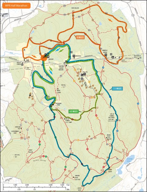
Print Map Download the PDF Ward Pound Ridge Half Marathon 13.1 miles of trails all through the park and then some. The first part starts off like the Leatherman’s Loop […]
Print Map Download the PDF Michigan Road to Kimberly Bridge 6 Mile Loop Meet at Michigan Road for a 6 mile loop that takes us around the Northern portion of […]
Print Map Download the PDF Kimberly Bridge Multiloop One of our longer runs, this loop starts at Kimberly Bridge and follows the Blue trail to the Rock trail around the […]
Print Map Download the PDF Town Park to Trailside Museum A good training run for anyone interested in running the Leatherman’s Loop. Start at the Lewisboro Town Park and follow […]
Print Map Download the PDF Town Park Short Loop The green loop is one of our shorter runs when conditions are poor or time is tight. Even though it’s only […]
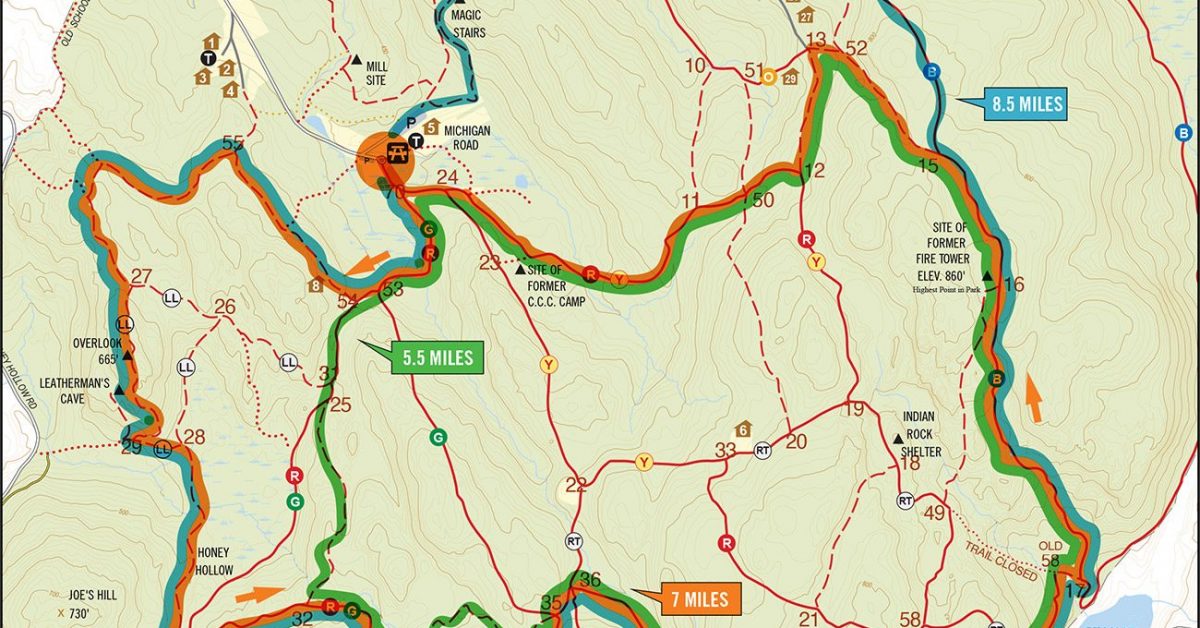
Print Map Download the PDF Ups and Downs 5 Mile Hill Workout Nothing will get you in shape faster than hills and this run has plenty of them. Only 5 […]
Print Map Download the PDF Fat Ass Run 7mi Originally conceived as a way to get the group off our backsides during the holiday season, this run is a perennial […]
Print Map Download the PDF Rob’s Run v1 6.5 mi This course starts at Michigan Road and follows some of the lesser-used trails in the Southern part of the park. […]
Print Map Download the PDF WPR Red Plus Route This is one of the easier runs in the park for the most part. Meet at Michigan Road and follow the […]
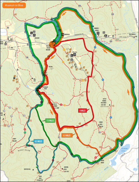
Print Map Download the PDF WPR Museum To Blue Route Start at the Trailside Museum up over the Magic Stairs to Michigan Road. Then into the woods on the RY […]
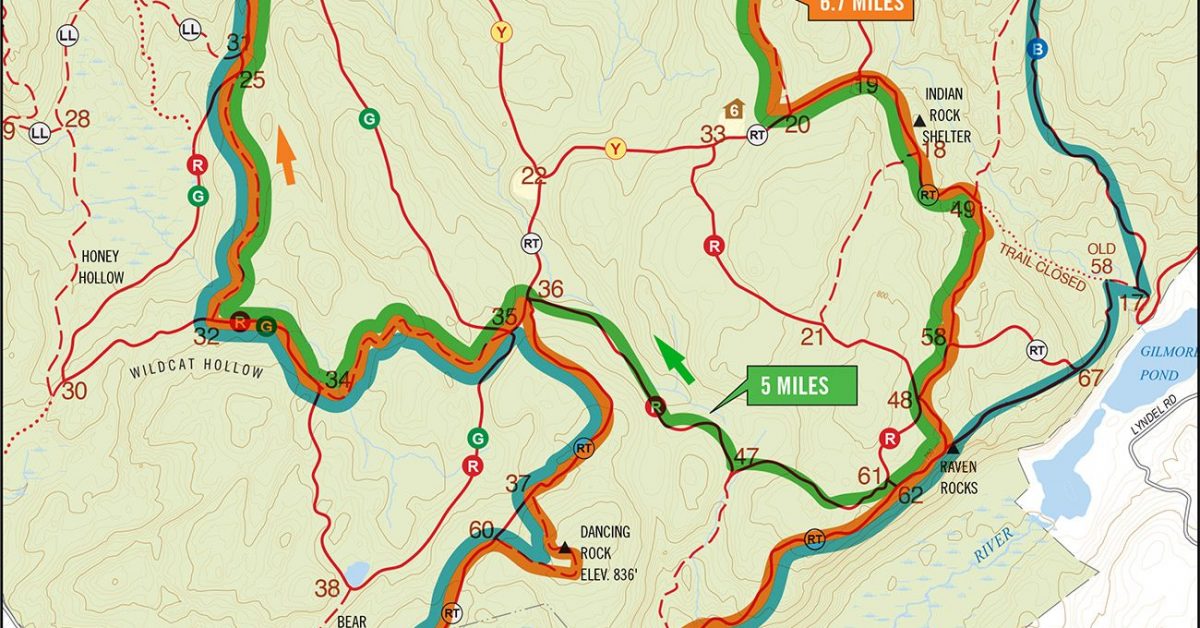
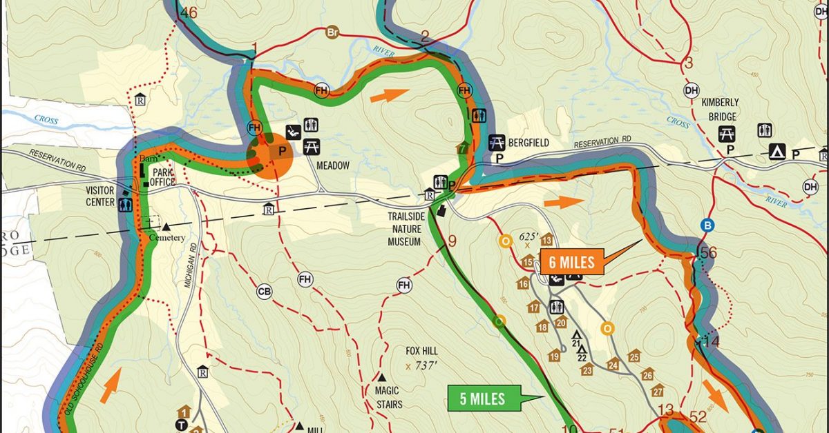
Print Map Download the PDF WPR Fire Tower Loop 6.2mi Another challenging but fun run starts at the Meadow Parking Lot and follows the FH trail to Michigan Road. From […]
Print Map Download the PDF Michigan Road Subway Series 2 This run swaps the traditional reservation map for a more stylized map and gives runners the opportunity to make their […]