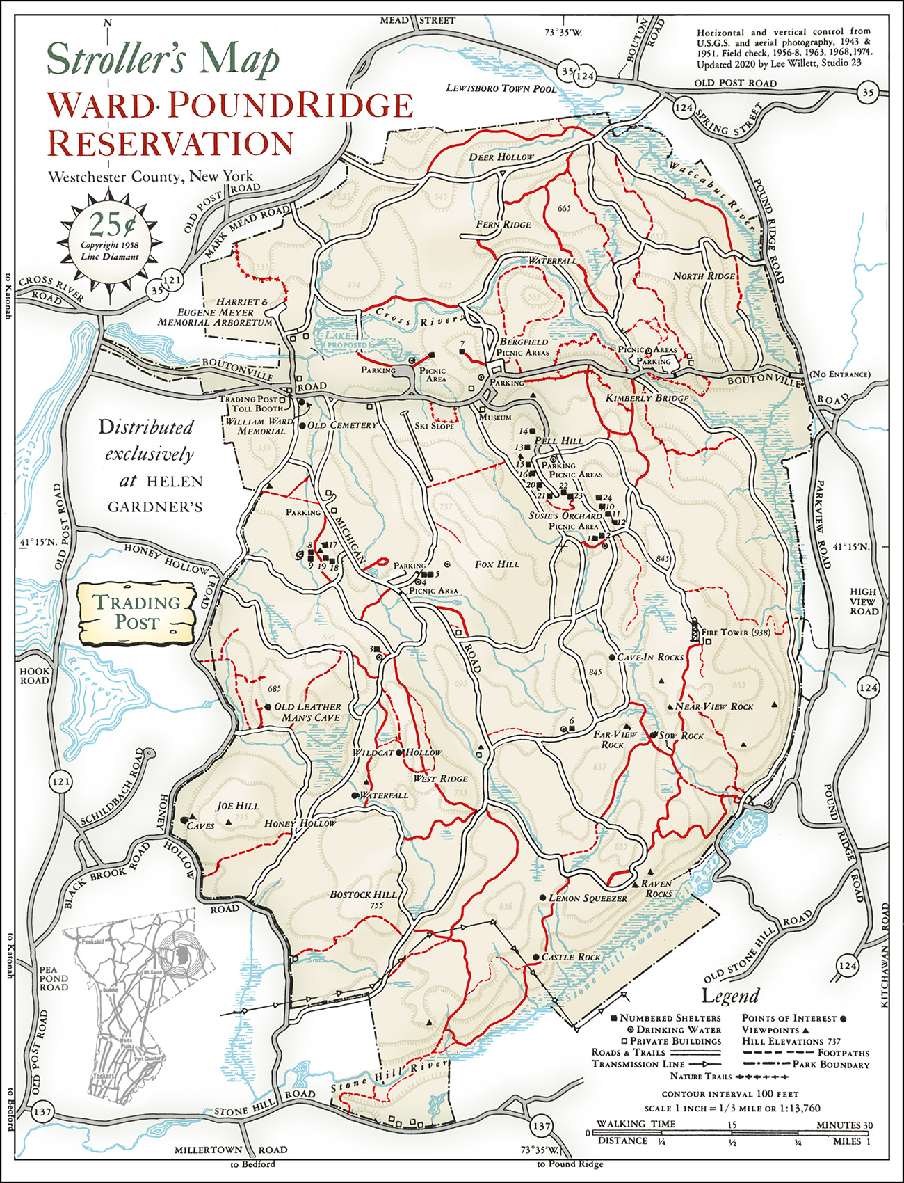
On Saturday, September 19, at 7:00 a.m., meet at Ward Pound Ridge Reservation, Michigan Road Lot, ready to explore with a sense of adventure. Below is a “Stroller’s Map” that was sold for a quarter at the “Trading Post” at the Rez from the 1950s through the 1970s. The map shows landmarks and trails that were known at the time. You’ll recognize a lot of these but some are unfamiliar. Let’s explore a little. I’ve found some of these old trails though you might call them enthusiastic bushwhacks today. I’ve found the Waterfall and Lemon Squeezer but I’m curious about the “caves” on Joe’s hill and the trails leading to Honey Hollow and Bostock Hill. Let’s do some exploring. Bring some bug spray, your own curiosity, and a sense of adventure.
Run Calendar
Spelunking

WHERE AND WHEN
UPCOMING
Fitness Friday
July 3 @ 5:45 am – 7:00 amAn event every week that begins at 5:45 am on Friday, repeating until December 18, 2026
Independence Day Run
July 4 @ 7:00 am – 9:00 amSubway Series
July 5 @ 8:00 am – 10:00 amTrail Tuesday
July 7 @ 5:30 am – 7:00 amAn event every week that begins at 5:30 am on Tuesday, repeating indefinitely
Workout Wednesday—Kimberly Bridge
July 8 @ 5:30 am – 7:00 amAn event every week that begins at 5:30 am on [day], repeating until December 30, 2026
Trail Thursday
July 9 @ 5:30 am – 7:00 amAn event every week that begins at 5:30 am on Thursday, repeating indefinitely
Fitness Friday
July 10 @ 5:45 am – 7:00 amAn event every week that begins at 5:45 am on Friday, repeating until December 18, 2026
Slide Mountain (Burroughs Range) Loop
July 11 @ 7:00 am – 4:00 pmTrail Tuesday
July 14 @ 5:30 am – 7:00 amAn event every week that begins at 5:30 am on Tuesday, repeating indefinitely
Workout Wednesday—Kimberly Bridge
July 15 @ 5:30 am – 7:00 amAn event every week that begins at 5:30 am on [day], repeating until December 30, 2026
TRAIL DAMAGE REPORT
Help keep the trails clear by reporting downed trees or other conditions that the park should know about.
Report Damage ››
DONATE
STAY ON COURSE
The Free Avenza Maps software now has a free trail map of the Reservation available here. You can use that or the free GaiaGPS to load KML files of some of our runs as overlays. Now there’s no excuse to get lost.
