No products in the cart.

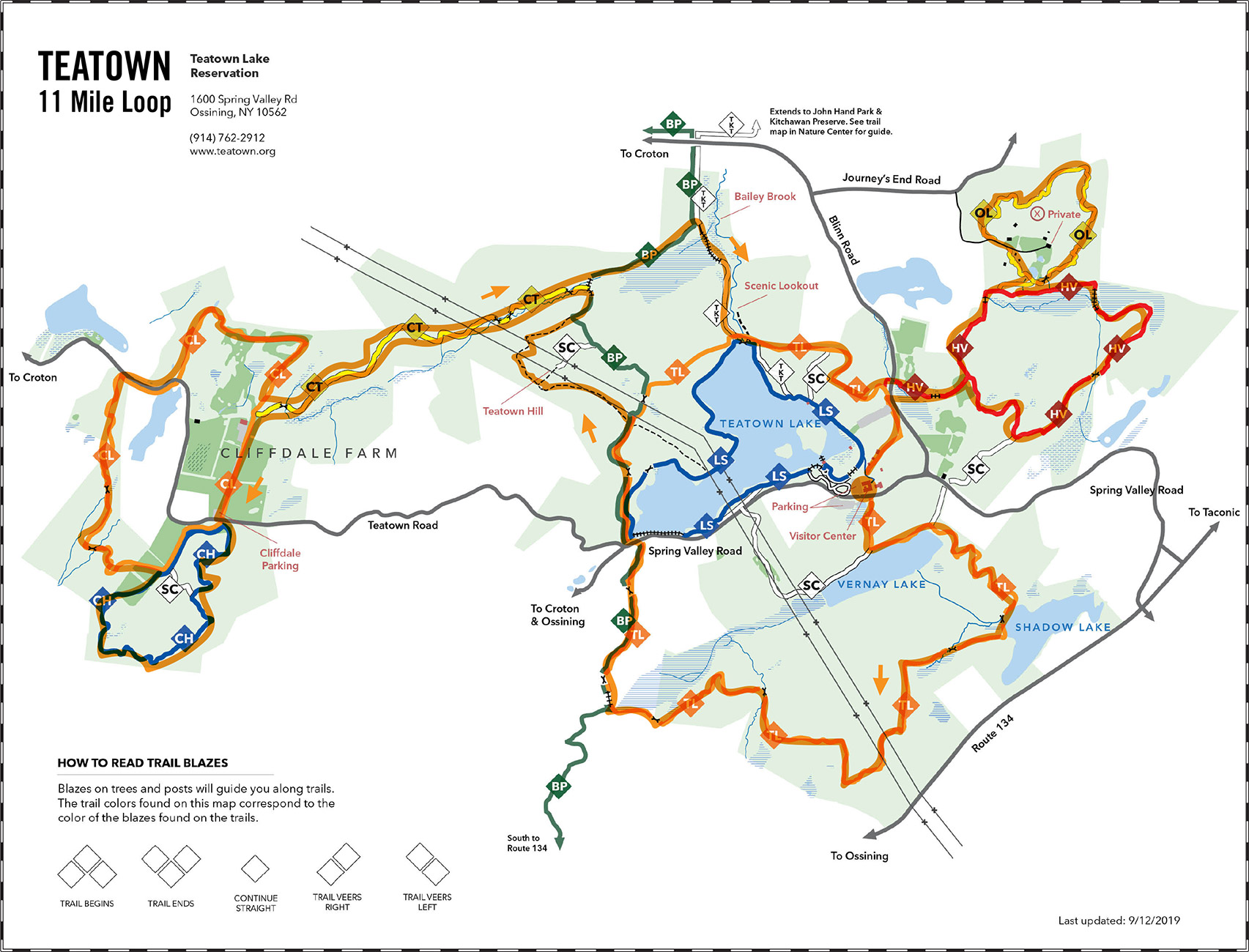
TEATOWN 11MILE LOOP
This course starts at the Teatown nature center and winds through trails on the southern and western part of the preserve before returning to the eastern trails and back. The full run is approximately 11 miles but there are easy ways to reduce the distance by eliminating the western loop or increase distance by adding the trails to the dam or the Teatown-Kitchawan Trail.
Upcoming
Trail Tuesday

Ward Pound Ridge Reservation, Michigan Road Lot
Michigan Road
Pound Ridge, NY 10576 United States + Google Map
Pound Ridge, NY 10576 United States + Google Map
Workout Wednesday—Trailside Museum

Trailside Museum
Reservation Road
Pound Ridge, NY 10576 United States + Google Map
Pound Ridge, NY 10576 United States + Google Map
Trail Thursday

Ward Pound Ridge Reservation, Michigan Road Lot
Michigan Road
Pound Ridge, NY 10576 United States + Google Map
Pound Ridge, NY 10576 United States + Google Map
Run the Numbers Part 4

Ward Pound Ridge Reservation, Michigan Road Lot
Michigan Road
Pound Ridge, NY 10576 United States + Google Map
Pound Ridge, NY 10576 United States + Google Map
Mudders & Grunters or Trailside & Town Park

Trailside Museum
Reservation Road
Pound Ridge, NY 10576 United States + Google Map
Pound Ridge, NY 10576 United States + Google Map
Trail Tuesday
Ward Pound Ridge Reservation, Michigan Road Lot
Michigan Road
Pound Ridge, NY 10576 United States + Google Map
Pound Ridge, NY 10576 United States + Google Map
Workout Wednesday—Trailside Museum
Trailside Museum
Reservation Road
Pound Ridge, NY 10576 United States + Google Map
Pound Ridge, NY 10576 United States + Google Map
Trail Thursday
Ward Pound Ridge Reservation, Michigan Road Lot
Michigan Road
Pound Ridge, NY 10576 United States + Google Map
Pound Ridge, NY 10576 United States + Google Map
Red/Rock Trail Loop

Ward Pound Ridge Reservation, Michigan Road Lot
Michigan Road
Pound Ridge, NY 10576 United States + Google Map
Pound Ridge, NY 10576 United States + Google Map
Trail Tuesday
Ward Pound Ridge Reservation, Michigan Road Lot
Michigan Road
Pound Ridge, NY 10576 United States + Google Map
Pound Ridge, NY 10576 United States + Google Map